You are here: Home > Network List > US - United States National Seismic Network Stations List
> Station HAWA Hanford, Washington, USA > Earthquake Result Viewer
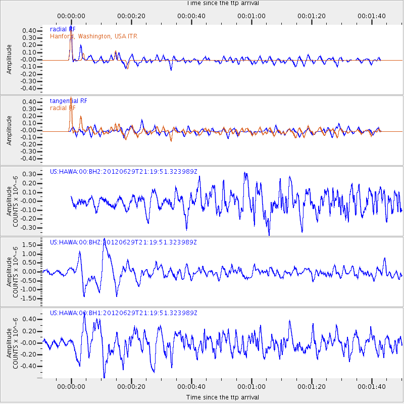
HAWA Hanford, Washington, USA - Earthquake Result Viewer
*The percent match for this event was below the threshold and hence no stack was calculated.
| Earthquake location: |
Northern Xinjiang, China |
| Earthquake latitude/longitude: |
43.4/84.7 |
| Earthquake time(UTC): |
2012/06/29 (181) 21:07:33 GMT |
| Earthquake Depth: |
18 km |
| Earthquake Magnitude: |
6.2 MB, 6.4 MS, 6.3 MW, 6.3 MW |
| Earthquake Catalog/Contributor: |
WHDF/NEIC |
|
| Network: |
US United States National Seismic Network |
| Station: |
HAWA Hanford, Washington, USA |
| Lat/Lon: |
46.39 N/119.53 W |
| Elevation: |
364 m |
|
| Distance: |
88.0 deg |
| Az: |
16.514 deg |
| Baz: |
342.592 deg |
| Ray Param: |
$rayparam |
*The percent match for this event was below the threshold and hence was not used in the summary stack. |
|
| Radial Match: |
79.487885 % |
| Radial Bump: |
400 |
| Transverse Match: |
77.23394 % |
| Transverse Bump: |
400 |
| SOD ConfigId: |
558545 |
| Insert Time: |
2013-09-19 21:29:51.360 +0000 |
| GWidth: |
2.5 |
| Max Bumps: |
400 |
| Tol: |
0.001 |
|
Signal To Noise
| Channel | StoN | STA | LTA |
| US:HAWA:00:BHZ:20120629T21:19:51.323989Z | 8.4883375 | 6.34264E-7 | 7.472182E-8 |
| US:HAWA:00:BH1:20120629T21:19:51.323989Z | 3.389483 | 2.4072756E-7 | 7.102191E-8 |
| US:HAWA:00:BH2:20120629T21:19:51.323989Z | 1.1765143 | 5.4673325E-8 | 4.6470603E-8 |
| Arrivals |
| Ps | |
| PpPs | |
| PsPs/PpSs | |


