You are here: Home > Network List > US - United States National Seismic Network Stations List
> Station MNTX Cornudas Mountains, Texas, USA > Earthquake Result Viewer
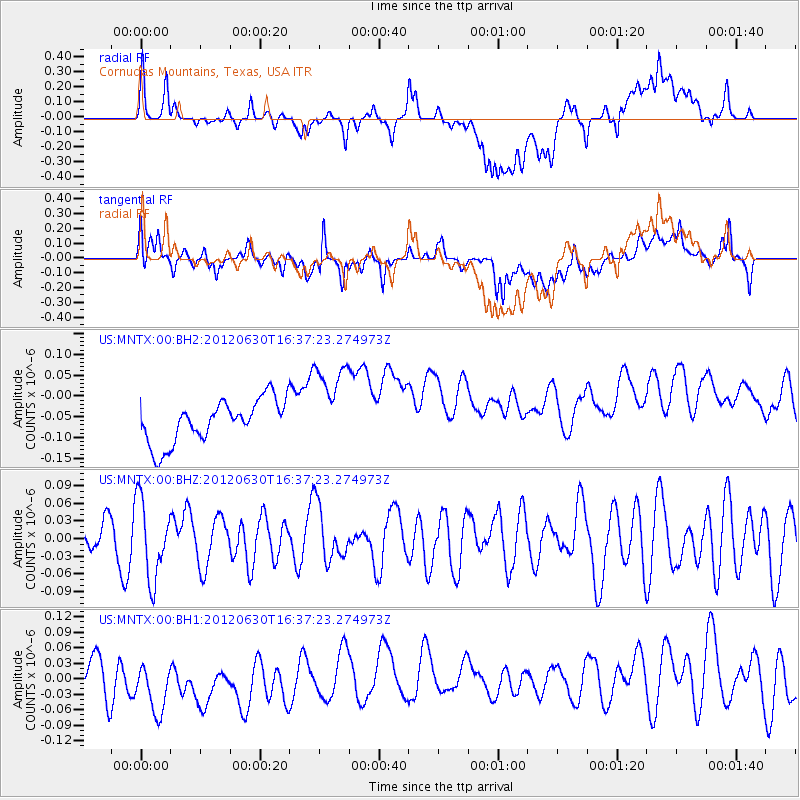
MNTX Cornudas Mountains, Texas, USA - Earthquake Result Viewer
*The percent match for this event was below the threshold and hence no stack was calculated.
| Earthquake location: |
Southeast Of Loyalty Islands |
| Earthquake latitude/longitude: |
-22.1/171.0 |
| Earthquake time(UTC): |
2012/06/30 (182) 16:24:36 GMT |
| Earthquake Depth: |
92 km |
| Earthquake Magnitude: |
5.5 MW |
| Earthquake Catalog/Contributor: |
NEIC PDE/NEIC PDE-M |
|
| Network: |
US United States National Seismic Network |
| Station: |
MNTX Cornudas Mountains, Texas, USA |
| Lat/Lon: |
31.70 N/105.38 W |
| Elevation: |
404 m |
|
| Distance: |
96.2 deg |
| Az: |
58.439 deg |
| Baz: |
247.994 deg |
| Ray Param: |
$rayparam |
*The percent match for this event was below the threshold and hence was not used in the summary stack. |
|
| Radial Match: |
38.212433 % |
| Radial Bump: |
400 |
| Transverse Match: |
54.19925 % |
| Transverse Bump: |
400 |
| SOD ConfigId: |
558545 |
| Insert Time: |
2013-09-19 21:32:09.974 +0000 |
| GWidth: |
2.5 |
| Max Bumps: |
400 |
| Tol: |
0.001 |
|
Signal To Noise
| Channel | StoN | STA | LTA |
| US:MNTX:00:BHZ:20120630T16:37:23.274973Z | 1.4297432 | 6.6505166E-8 | 4.6515463E-8 |
| US:MNTX:00:BH1:20120630T16:37:23.274973Z | 1.8431677 | 6.5042514E-8 | 3.5288444E-8 |
| US:MNTX:00:BH2:20120630T16:37:23.274973Z | 2.0617778 | 1.0601052E-7 | 5.1417043E-8 |
| Arrivals |
| Ps | |
| PpPs | |
| PsPs/PpSs | |


