You are here: Home > Network List > US - United States National Seismic Network Stations List
> Station MSO Missoula, Montana, USA > Earthquake Result Viewer
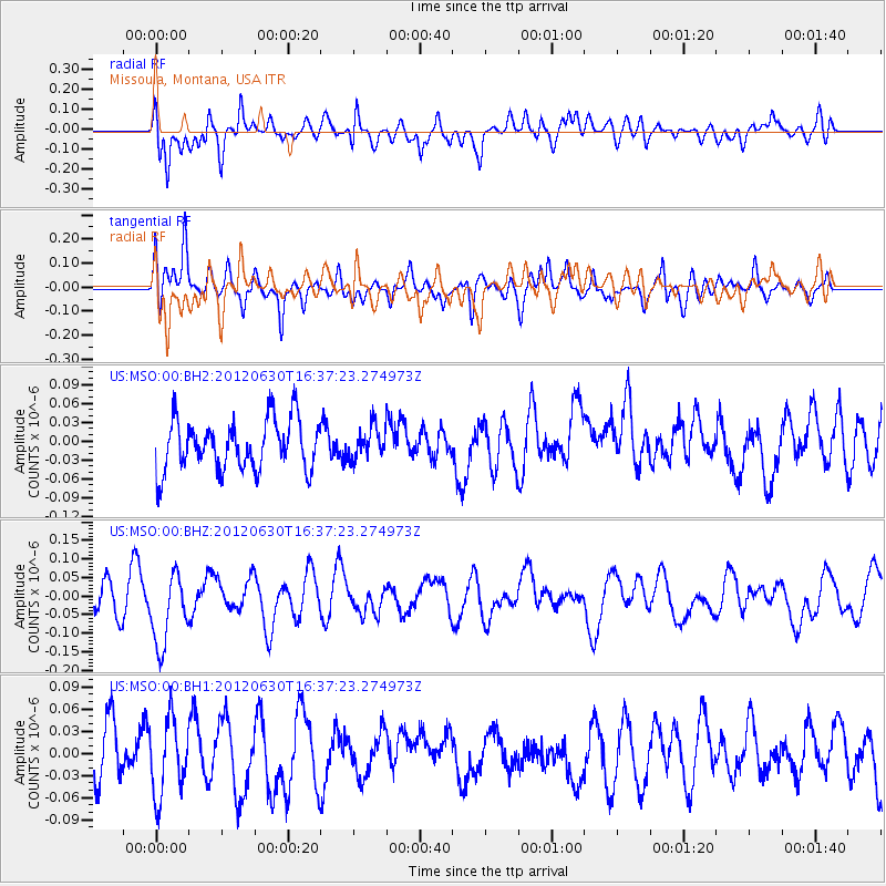
MSO Missoula, Montana, USA - Earthquake Result Viewer
*The percent match for this event was below the threshold and hence no stack was calculated.
| Earthquake location: |
Southeast Of Loyalty Islands |
| Earthquake latitude/longitude: |
-22.1/171.0 |
| Earthquake time(UTC): |
2012/06/30 (182) 16:24:36 GMT |
| Earthquake Depth: |
92 km |
| Earthquake Magnitude: |
5.5 MW |
| Earthquake Catalog/Contributor: |
NEIC PDE/NEIC PDE-M |
|
| Network: |
US United States National Seismic Network |
| Station: |
MSO Missoula, Montana, USA |
| Lat/Lon: |
46.83 N/113.94 W |
| Elevation: |
1264 m |
|
| Distance: |
96.2 deg |
| Az: |
41.86 deg |
| Baz: |
244.343 deg |
| Ray Param: |
$rayparam |
*The percent match for this event was below the threshold and hence was not used in the summary stack. |
|
| Radial Match: |
55.527588 % |
| Radial Bump: |
400 |
| Transverse Match: |
49.52797 % |
| Transverse Bump: |
400 |
| SOD ConfigId: |
558545 |
| Insert Time: |
2013-09-19 21:32:10.757 +0000 |
| GWidth: |
2.5 |
| Max Bumps: |
400 |
| Tol: |
0.001 |
|
Signal To Noise
| Channel | StoN | STA | LTA |
| US:MSO:00:BHZ:20120630T16:37:23.274973Z | 1.89496 | 1.0534936E-7 | 5.5594505E-8 |
| US:MSO:00:BH1:20120630T16:37:23.274973Z | 0.96607006 | 5.0762225E-8 | 5.2545076E-8 |
| US:MSO:00:BH2:20120630T16:37:23.274973Z | 0.63578784 | 2.5367196E-8 | 3.9898836E-8 |
| Arrivals |
| Ps | |
| PpPs | |
| PsPs/PpSs | |


