You are here: Home > Network List > II - Global Seismograph Network (GSN - IRIS/IDA) Stations List
> Station WRAB Tennant Creek, NT, Australia > Earthquake Result Viewer
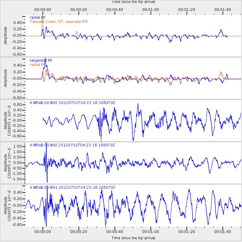
WRAB Tennant Creek, NT, Australia - Earthquake Result Viewer
*The percent match for this event was below the threshold and hence no stack was calculated.
| Earthquake location: |
Myanmar-India Border Region |
| Earthquake latitude/longitude: |
25.6/94.7 |
| Earthquake time(UTC): |
2012/07/01 (183) 04:13:52 GMT |
| Earthquake Depth: |
58 km |
| Earthquake Magnitude: |
5.5 MB, 5.6 MW, 5.6 MW |
| Earthquake Catalog/Contributor: |
WHDF/NEIC |
|
| Network: |
II Global Seismograph Network (GSN - IRIS/IDA) |
| Station: |
WRAB Tennant Creek, NT, Australia |
| Lat/Lon: |
19.93 S/134.36 E |
| Elevation: |
366 m |
|
| Distance: |
59.4 deg |
| Az: |
135.784 deg |
| Baz: |
317.984 deg |
| Ray Param: |
$rayparam |
*The percent match for this event was below the threshold and hence was not used in the summary stack. |
|
| Radial Match: |
49.8445 % |
| Radial Bump: |
400 |
| Transverse Match: |
67.121155 % |
| Transverse Bump: |
400 |
| SOD ConfigId: |
558545 |
| Insert Time: |
2013-09-19 21:33:11.121 +0000 |
| GWidth: |
2.5 |
| Max Bumps: |
400 |
| Tol: |
0.001 |
|
Signal To Noise
| Channel | StoN | STA | LTA |
| II:WRAB:00:BHZ:20120701T04:23:18.168979Z | 2.064615 | 5.4945264E-7 | 2.6612838E-7 |
| II:WRAB:00:BH1:20120701T04:23:18.168979Z | 1.3139913 | 2.3722929E-7 | 1.80541E-7 |
| II:WRAB:00:BH2:20120701T04:23:18.168979Z | 2.2399237 | 2.79193E-7 | 1.2464396E-7 |
| Arrivals |
| Ps | |
| PpPs | |
| PsPs/PpSs | |


