You are here: Home > Network List > CU - Caribbean Network (USGS) Stations List
> Station GTBY Guantanamo Bay, Cuba > Earthquake Result Viewer
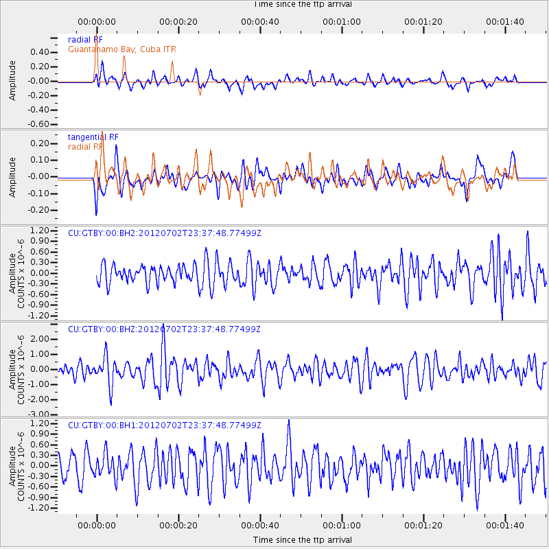
GTBY Guantanamo Bay, Cuba - Earthquake Result Viewer
*The percent match for this event was below the threshold and hence no stack was calculated.
| Earthquake location: |
Near Coast Of Peru |
| Earthquake latitude/longitude: |
-14.4/-75.6 |
| Earthquake time(UTC): |
2012/07/02 (184) 23:31:37 GMT |
| Earthquake Depth: |
40 km |
| Earthquake Magnitude: |
6.0 MB, 5.2 MS, 5.7 MW, 5.6 MW |
| Earthquake Catalog/Contributor: |
WHDF/NEIC |
|
| Network: |
CU Caribbean Network (USGS) |
| Station: |
GTBY Guantanamo Bay, Cuba |
| Lat/Lon: |
19.93 N/75.11 W |
| Elevation: |
79 m |
|
| Distance: |
34.1 deg |
| Az: |
0.817 deg |
| Baz: |
180.841 deg |
| Ray Param: |
$rayparam |
*The percent match for this event was below the threshold and hence was not used in the summary stack. |
|
| Radial Match: |
62.396114 % |
| Radial Bump: |
400 |
| Transverse Match: |
51.887295 % |
| Transverse Bump: |
400 |
| SOD ConfigId: |
558545 |
| Insert Time: |
2013-09-19 21:34:32.000 +0000 |
| GWidth: |
2.5 |
| Max Bumps: |
400 |
| Tol: |
0.001 |
|
Signal To Noise
| Channel | StoN | STA | LTA |
| CU:GTBY:00:BHZ:20120702T23:37:48.77499Z | 2.7254553 | 9.310339E-7 | 3.4160675E-7 |
| CU:GTBY:00:BH1:20120702T23:37:48.77499Z | 0.9451266 | 3.3527087E-7 | 3.5473647E-7 |
| CU:GTBY:00:BH2:20120702T23:37:48.77499Z | 1.2814487 | 2.8562266E-7 | 2.2289042E-7 |
| Arrivals |
| Ps | |
| PpPs | |
| PsPs/PpSs | |


