You are here: Home > Network List > US - United States National Seismic Network Stations List
> Station HAWA Hanford, Washington, USA > Earthquake Result Viewer
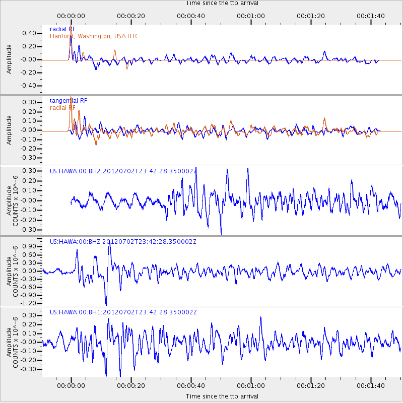
HAWA Hanford, Washington, USA - Earthquake Result Viewer
*The percent match for this event was below the threshold and hence no stack was calculated.
| Earthquake location: |
Near Coast Of Peru |
| Earthquake latitude/longitude: |
-14.4/-75.6 |
| Earthquake time(UTC): |
2012/07/02 (184) 23:31:37 GMT |
| Earthquake Depth: |
40 km |
| Earthquake Magnitude: |
6.0 MB, 5.2 MS, 5.7 MW, 5.6 MW |
| Earthquake Catalog/Contributor: |
WHDF/NEIC |
|
| Network: |
US United States National Seismic Network |
| Station: |
HAWA Hanford, Washington, USA |
| Lat/Lon: |
46.39 N/119.53 W |
| Elevation: |
364 m |
|
| Distance: |
72.3 deg |
| Az: |
329.726 deg |
| Baz: |
135.113 deg |
| Ray Param: |
$rayparam |
*The percent match for this event was below the threshold and hence was not used in the summary stack. |
|
| Radial Match: |
73.368324 % |
| Radial Bump: |
400 |
| Transverse Match: |
73.74869 % |
| Transverse Bump: |
400 |
| SOD ConfigId: |
558545 |
| Insert Time: |
2013-09-19 21:36:49.619 +0000 |
| GWidth: |
2.5 |
| Max Bumps: |
400 |
| Tol: |
0.001 |
|
Signal To Noise
| Channel | StoN | STA | LTA |
| US:HAWA:00:BHZ:20120702T23:42:28.350002Z | 4.5903473 | 3.2186688E-7 | 7.01182E-8 |
| US:HAWA:00:BH1:20120702T23:42:28.350002Z | 1.290001 | 9.176472E-8 | 7.113538E-8 |
| US:HAWA:00:BH2:20120702T23:42:28.350002Z | 1.638661 | 7.513076E-8 | 4.584887E-8 |
| Arrivals |
| Ps | |
| PpPs | |
| PsPs/PpSs | |


