You are here: Home > Network List > II - Global Seismograph Network (GSN - IRIS/IDA) Stations List
> Station PFO Pinon Flat, California, USA > Earthquake Result Viewer
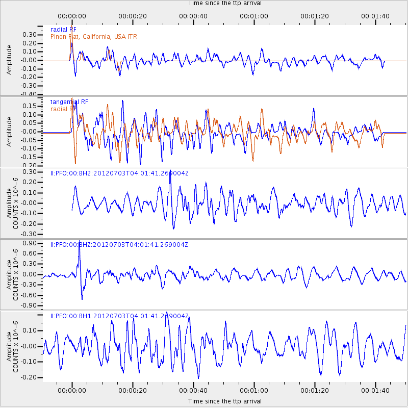
PFO Pinon Flat, California, USA - Earthquake Result Viewer
*The percent match for this event was below the threshold and hence no stack was calculated.
| Earthquake location: |
Solomon Islands |
| Earthquake latitude/longitude: |
-10.8/163.3 |
| Earthquake time(UTC): |
2012/07/03 (185) 03:49:33 GMT |
| Earthquake Depth: |
92 km |
| Earthquake Magnitude: |
5.6 MB, 5.5 MW, 5.5 MW |
| Earthquake Catalog/Contributor: |
WHDF/NEIC |
|
| Network: |
II Global Seismograph Network (GSN - IRIS/IDA) |
| Station: |
PFO Pinon Flat, California, USA |
| Lat/Lon: |
33.61 N/116.46 W |
| Elevation: |
1280 m |
|
| Distance: |
87.9 deg |
| Az: |
55.379 deg |
| Baz: |
255.651 deg |
| Ray Param: |
$rayparam |
*The percent match for this event was below the threshold and hence was not used in the summary stack. |
|
| Radial Match: |
50.75488 % |
| Radial Bump: |
400 |
| Transverse Match: |
71.12356 % |
| Transverse Bump: |
400 |
| SOD ConfigId: |
558545 |
| Insert Time: |
2013-09-19 21:39:27.401 +0000 |
| GWidth: |
2.5 |
| Max Bumps: |
400 |
| Tol: |
0.001 |
|
Signal To Noise
| Channel | StoN | STA | LTA |
| II:PFO:00:BHZ:20120703T04:01:41.269004Z | 3.9251065 | 3.4747046E-7 | 8.8525105E-8 |
| II:PFO:00:BH1:20120703T04:01:41.269004Z | 0.42088258 | 3.3632304E-8 | 7.990899E-8 |
| II:PFO:00:BH2:20120703T04:01:41.269004Z | 2.589776 | 1.4812306E-7 | 5.7195315E-8 |
| Arrivals |
| Ps | |
| PpPs | |
| PsPs/PpSs | |


