You are here: Home > Network List > TA - USArray Transportable Network (new EarthScope stations) Stations List
> Station J04D Umpqua National Forest, Toketee, OR, USA > Earthquake Result Viewer
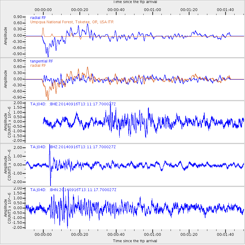
J04D Umpqua National Forest, Toketee, OR, USA - Earthquake Result Viewer
*The percent match for this event was below the threshold and hence no stack was calculated.
| Earthquake location: |
South Of Fiji Islands |
| Earthquake latitude/longitude: |
-22.3/-179.5 |
| Earthquake time(UTC): |
2014/09/16 (259) 13:00:20 GMT |
| Earthquake Depth: |
585 km |
| Earthquake Magnitude: |
5.5 MW |
| Earthquake Catalog/Contributor: |
ISC/ISC |
|
| Network: |
TA USArray Transportable Network (new EarthScope stations) |
| Station: |
J04D Umpqua National Forest, Toketee, OR, USA |
| Lat/Lon: |
43.24 N/122.11 W |
| Elevation: |
1948 m |
|
| Distance: |
83.8 deg |
| Az: |
38.241 deg |
| Baz: |
231.665 deg |
| Ray Param: |
$rayparam |
*The percent match for this event was below the threshold and hence was not used in the summary stack. |
|
| Radial Match: |
67.26998 % |
| Radial Bump: |
400 |
| Transverse Match: |
43.084034 % |
| Transverse Bump: |
400 |
| SOD ConfigId: |
3390531 |
| Insert Time: |
2019-04-14 02:10:37.706 +0000 |
| GWidth: |
2.5 |
| Max Bumps: |
400 |
| Tol: |
0.001 |
|
Signal To Noise
| Channel | StoN | STA | LTA |
| TA:J04D: :BHZ:20140916T13:11:17.700027Z | 4.6720705 | 7.452393E-7 | 1.5950943E-7 |
| TA:J04D: :BHN:20140916T13:11:17.700027Z | 1.5651181 | 4.121717E-7 | 2.6334862E-7 |
| TA:J04D: :BHE:20140916T13:11:17.700027Z | 0.9510293 | 3.332559E-7 | 3.5041603E-7 |
| Arrivals |
| Ps | |
| PpPs | |
| PsPs/PpSs | |


