You are here: Home > Network List > US - United States National Seismic Network Stations List
> Station EGMT Eagleton, Montana, USA > Earthquake Result Viewer
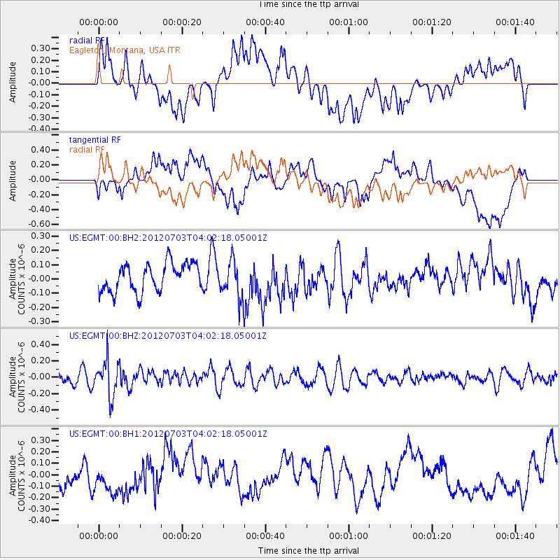
EGMT Eagleton, Montana, USA - Earthquake Result Viewer
*The percent match for this event was below the threshold and hence no stack was calculated.
| Earthquake location: |
Solomon Islands |
| Earthquake latitude/longitude: |
-10.8/163.3 |
| Earthquake time(UTC): |
2012/07/03 (185) 03:49:33 GMT |
| Earthquake Depth: |
92 km |
| Earthquake Magnitude: |
5.6 MB, 5.5 MW, 5.5 MW |
| Earthquake Catalog/Contributor: |
WHDF/NEIC |
|
| Network: |
US United States National Seismic Network |
| Station: |
EGMT Eagleton, Montana, USA |
| Lat/Lon: |
48.02 N/109.75 W |
| Elevation: |
1055 m |
|
| Distance: |
95.9 deg |
| Az: |
42.368 deg |
| Baz: |
260.487 deg |
| Ray Param: |
$rayparam |
*The percent match for this event was below the threshold and hence was not used in the summary stack. |
|
| Radial Match: |
59.701046 % |
| Radial Bump: |
400 |
| Transverse Match: |
56.384705 % |
| Transverse Bump: |
400 |
| SOD ConfigId: |
558545 |
| Insert Time: |
2013-09-19 21:40:18.996 +0000 |
| GWidth: |
2.5 |
| Max Bumps: |
400 |
| Tol: |
0.001 |
|
Signal To Noise
| Channel | StoN | STA | LTA |
| US:EGMT:00:BHZ:20120703T04:02:18.05001Z | 3.7291913 | 2.2231241E-7 | 5.961411E-8 |
| US:EGMT:00:BH1:20120703T04:02:18.05001Z | 0.97309834 | 1.025817E-7 | 1.0541761E-7 |
| US:EGMT:00:BH2:20120703T04:02:18.05001Z | 1.359871 | 1.3415377E-7 | 9.865183E-8 |
| Arrivals |
| Ps | |
| PpPs | |
| PsPs/PpSs | |


