You are here: Home > Network List > US - United States National Seismic Network Stations List
> Station HAWA Hanford, Washington, USA > Earthquake Result Viewer
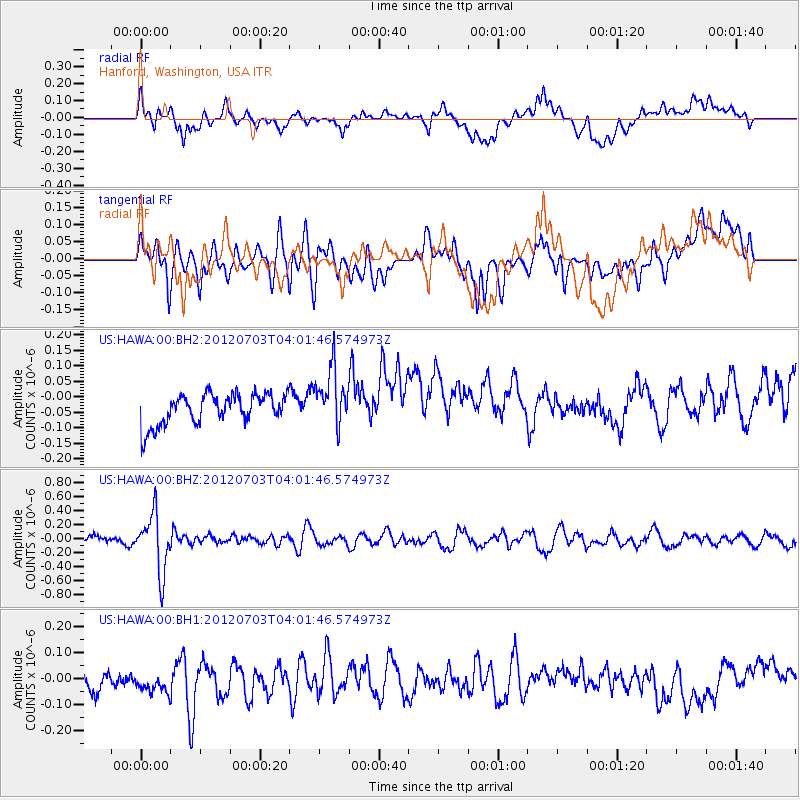
HAWA Hanford, Washington, USA - Earthquake Result Viewer
*The percent match for this event was below the threshold and hence no stack was calculated.
| Earthquake location: |
Solomon Islands |
| Earthquake latitude/longitude: |
-10.8/163.3 |
| Earthquake time(UTC): |
2012/07/03 (185) 03:49:33 GMT |
| Earthquake Depth: |
92 km |
| Earthquake Magnitude: |
5.6 MB, 5.5 MW, 5.5 MW |
| Earthquake Catalog/Contributor: |
WHDF/NEIC |
|
| Network: |
US United States National Seismic Network |
| Station: |
HAWA Hanford, Washington, USA |
| Lat/Lon: |
46.39 N/119.53 W |
| Elevation: |
364 m |
|
| Distance: |
89.0 deg |
| Az: |
42.444 deg |
| Baz: |
253.322 deg |
| Ray Param: |
$rayparam |
*The percent match for this event was below the threshold and hence was not used in the summary stack. |
|
| Radial Match: |
52.183105 % |
| Radial Bump: |
400 |
| Transverse Match: |
54.28797 % |
| Transverse Bump: |
400 |
| SOD ConfigId: |
558545 |
| Insert Time: |
2013-09-19 21:40:19.969 +0000 |
| GWidth: |
2.5 |
| Max Bumps: |
400 |
| Tol: |
0.001 |
|
Signal To Noise
| Channel | StoN | STA | LTA |
| US:HAWA:00:BHZ:20120703T04:01:46.574973Z | 5.6566596 | 4.159351E-7 | 7.353015E-8 |
| US:HAWA:00:BH1:20120703T04:01:46.574973Z | 0.9270533 | 4.4926455E-8 | 4.846157E-8 |
| US:HAWA:00:BH2:20120703T04:01:46.574973Z | 1.8543559 | 9.2066365E-8 | 4.96487E-8 |
| Arrivals |
| Ps | |
| PpPs | |
| PsPs/PpSs | |


