You are here: Home > Network List > TA - USArray Transportable Network (new EarthScope stations) Stations List
> Station O03E Paynes Creek, CA, USA > Earthquake Result Viewer
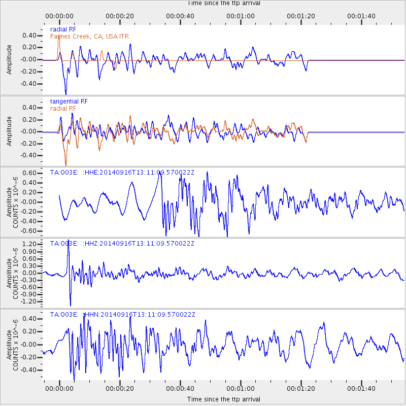
O03E Paynes Creek, CA, USA - Earthquake Result Viewer
*The percent match for this event was below the threshold and hence no stack was calculated.
| Earthquake location: |
South Of Fiji Islands |
| Earthquake latitude/longitude: |
-22.3/-179.5 |
| Earthquake time(UTC): |
2014/09/16 (259) 13:00:20 GMT |
| Earthquake Depth: |
585 km |
| Earthquake Magnitude: |
5.5 MW |
| Earthquake Catalog/Contributor: |
ISC/ISC |
|
| Network: |
TA USArray Transportable Network (new EarthScope stations) |
| Station: |
O03E Paynes Creek, CA, USA |
| Lat/Lon: |
40.29 N/121.80 W |
| Elevation: |
967 m |
|
| Distance: |
82.2 deg |
| Az: |
40.718 deg |
| Baz: |
232.171 deg |
| Ray Param: |
$rayparam |
*The percent match for this event was below the threshold and hence was not used in the summary stack. |
|
| Radial Match: |
42.035076 % |
| Radial Bump: |
348 |
| Transverse Match: |
45.262688 % |
| Transverse Bump: |
320 |
| SOD ConfigId: |
3390531 |
| Insert Time: |
2019-04-14 02:10:45.184 +0000 |
| GWidth: |
2.5 |
| Max Bumps: |
400 |
| Tol: |
0.001 |
|
Signal To Noise
| Channel | StoN | STA | LTA |
| TA:O03E: :HHZ:20140916T13:11:09.570022Z | 3.5909991 | 5.210793E-7 | 1.4510705E-7 |
| TA:O03E: :HHN:20140916T13:11:09.570022Z | 1.4945824 | 1.8664069E-7 | 1.2487814E-7 |
| TA:O03E: :HHE:20140916T13:11:09.570022Z | 2.0228443 | 3.4471492E-7 | 1.70411E-7 |
| Arrivals |
| Ps | |
| PpPs | |
| PsPs/PpSs | |


