You are here: Home > Network List > IU - Global Seismograph Network (GSN - IRIS/USGS) Stations List
> Station PMG Port Moresby, New Guinea > Earthquake Result Viewer
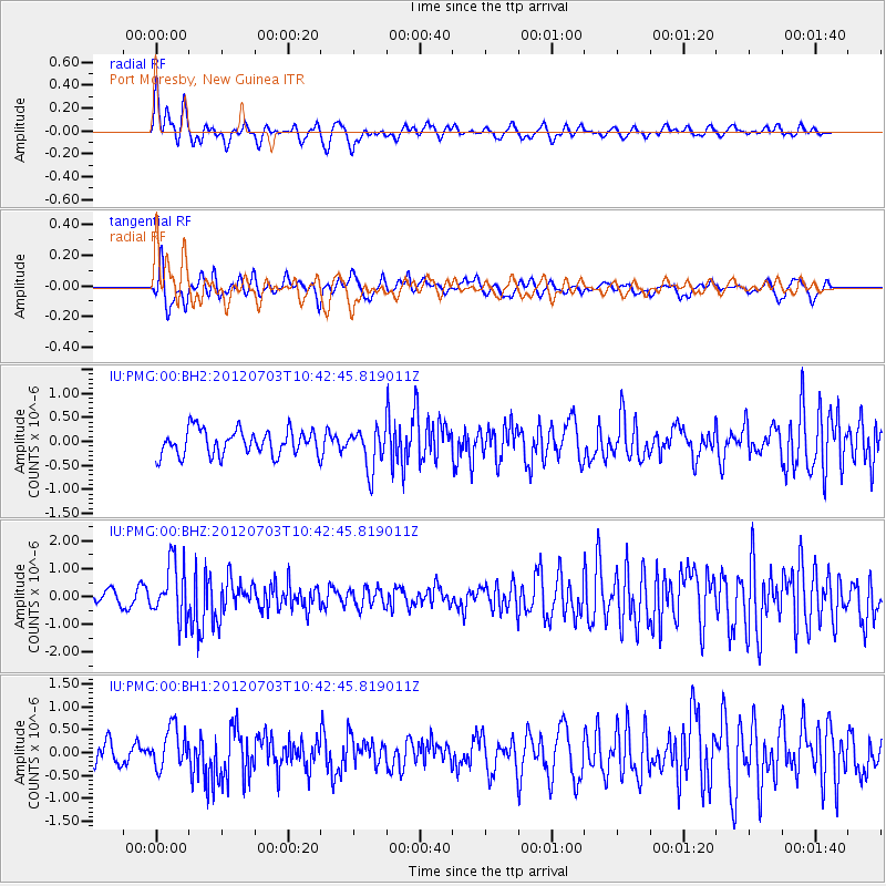
PMG Port Moresby, New Guinea - Earthquake Result Viewer
*The percent match for this event was below the threshold and hence no stack was calculated.
| Earthquake location: |
Cook Strait, New Zealand |
| Earthquake latitude/longitude: |
-40.0/173.8 |
| Earthquake time(UTC): |
2012/07/03 (185) 10:36:15 GMT |
| Earthquake Depth: |
230 km |
| Earthquake Magnitude: |
5.9 MB, 6.3 MW, 6.3 MW |
| Earthquake Catalog/Contributor: |
WHDF/NEIC |
|
| Network: |
IU Global Seismograph Network (GSN - IRIS/USGS) |
| Station: |
PMG Port Moresby, New Guinea |
| Lat/Lon: |
9.40 S/147.16 E |
| Elevation: |
90 m |
|
| Distance: |
38.6 deg |
| Az: |
314.919 deg |
| Baz: |
146.56 deg |
| Ray Param: |
$rayparam |
*The percent match for this event was below the threshold and hence was not used in the summary stack. |
|
| Radial Match: |
74.54445 % |
| Radial Bump: |
400 |
| Transverse Match: |
58.73079 % |
| Transverse Bump: |
400 |
| SOD ConfigId: |
558545 |
| Insert Time: |
2013-09-19 21:42:18.343 +0000 |
| GWidth: |
2.5 |
| Max Bumps: |
400 |
| Tol: |
0.001 |
|
Signal To Noise
| Channel | StoN | STA | LTA |
| IU:PMG:00:BHZ:20120703T10:42:45.819011Z | 3.1123295 | 9.948079E-7 | 3.1963452E-7 |
| IU:PMG:00:BH1:20120703T10:42:45.819011Z | 1.4351968 | 4.5399426E-7 | 3.1632894E-7 |
| IU:PMG:00:BH2:20120703T10:42:45.819011Z | 1.61573 | 4.290271E-7 | 2.655314E-7 |
| Arrivals |
| Ps | |
| PpPs | |
| PsPs/PpSs | |


