You are here: Home > Network List > UW - Pacific Northwest Regional Seismic Network Stations List
> Station LCCR Mulino, OR, USA > Earthquake Result Viewer
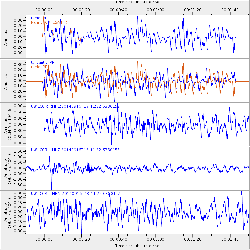
LCCR Mulino, OR, USA - Earthquake Result Viewer
*The percent match for this event was below the threshold and hence no stack was calculated.
| Earthquake location: |
South Of Fiji Islands |
| Earthquake latitude/longitude: |
-22.3/-179.5 |
| Earthquake time(UTC): |
2014/09/16 (259) 13:00:20 GMT |
| Earthquake Depth: |
585 km |
| Earthquake Magnitude: |
5.5 MW |
| Earthquake Catalog/Contributor: |
ISC/ISC |
|
| Network: |
UW Pacific Northwest Regional Seismic Network |
| Station: |
LCCR Mulino, OR, USA |
| Lat/Lon: |
45.21 N/122.48 W |
| Elevation: |
273 m |
|
| Distance: |
84.9 deg |
| Az: |
36.531 deg |
| Baz: |
231.24 deg |
| Ray Param: |
$rayparam |
*The percent match for this event was below the threshold and hence was not used in the summary stack. |
|
| Radial Match: |
52.19879 % |
| Radial Bump: |
400 |
| Transverse Match: |
55.115078 % |
| Transverse Bump: |
400 |
| SOD ConfigId: |
3390531 |
| Insert Time: |
2019-04-14 02:11:39.809 +0000 |
| GWidth: |
2.5 |
| Max Bumps: |
400 |
| Tol: |
0.001 |
|
Signal To Noise
| Channel | StoN | STA | LTA |
| UW:LCCR: :HHZ:20140916T13:11:22.638015Z | 4.3138223 | 5.981756E-7 | 1.3866486E-7 |
| UW:LCCR: :HHN:20140916T13:11:22.638015Z | 1.0851821 | 2.7421834E-7 | 2.5269338E-7 |
| UW:LCCR: :HHE:20140916T13:11:22.638015Z | 0.7428982 | 2.1914892E-7 | 2.9499185E-7 |
| Arrivals |
| Ps | |
| PpPs | |
| PsPs/PpSs | |


