You are here: Home > Network List > UW - Pacific Northwest Regional Seismic Network Stations List
> Station UMAT Pilot Rock, OR, USA > Earthquake Result Viewer
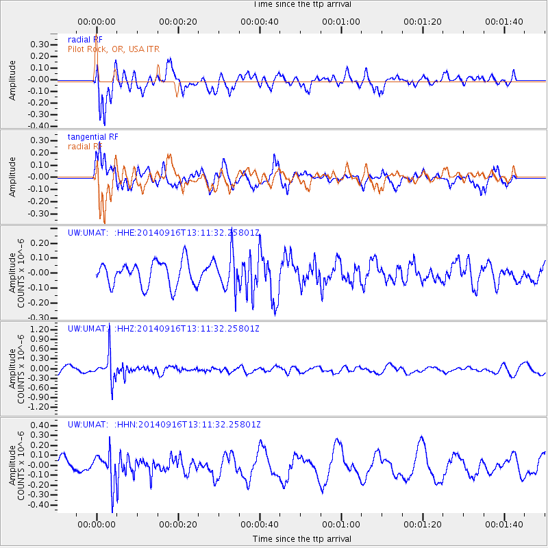
UMAT Pilot Rock, OR, USA - Earthquake Result Viewer
*The percent match for this event was below the threshold and hence no stack was calculated.
| Earthquake location: |
South Of Fiji Islands |
| Earthquake latitude/longitude: |
-22.3/-179.5 |
| Earthquake time(UTC): |
2014/09/16 (259) 13:00:20 GMT |
| Earthquake Depth: |
585 km |
| Earthquake Magnitude: |
5.5 MW |
| Earthquake Catalog/Contributor: |
ISC/ISC |
|
| Network: |
UW Pacific Northwest Regional Seismic Network |
| Station: |
UMAT Pilot Rock, OR, USA |
| Lat/Lon: |
45.29 N/118.96 W |
| Elevation: |
1318 m |
|
| Distance: |
86.9 deg |
| Az: |
37.979 deg |
| Baz: |
233.836 deg |
| Ray Param: |
$rayparam |
*The percent match for this event was below the threshold and hence was not used in the summary stack. |
|
| Radial Match: |
69.669426 % |
| Radial Bump: |
400 |
| Transverse Match: |
61.576473 % |
| Transverse Bump: |
394 |
| SOD ConfigId: |
3390531 |
| Insert Time: |
2019-04-14 02:11:47.319 +0000 |
| GWidth: |
2.5 |
| Max Bumps: |
400 |
| Tol: |
0.001 |
|
Signal To Noise
| Channel | StoN | STA | LTA |
| UW:UMAT: :HHZ:20140916T13:11:32.25801Z | 3.3554642 | 4.1272074E-7 | 1.229996E-7 |
| UW:UMAT: :HHN:20140916T13:11:32.25801Z | 1.5470911 | 1.5331422E-7 | 9.909837E-8 |
| UW:UMAT: :HHE:20140916T13:11:32.25801Z | 1.4144186 | 1.15221944E-7 | 8.14624E-8 |
| Arrivals |
| Ps | |
| PpPs | |
| PsPs/PpSs | |


