You are here: Home > Network List > US - United States National Seismic Network Stations List
> Station MSO Missoula, Montana, USA > Earthquake Result Viewer
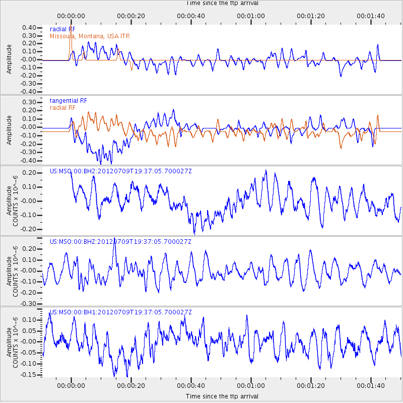
MSO Missoula, Montana, USA - Earthquake Result Viewer
*The percent match for this event was below the threshold and hence no stack was calculated.
| Earthquake location: |
Ryukyu Islands, Japan |
| Earthquake latitude/longitude: |
29.4/130.1 |
| Earthquake time(UTC): |
2012/07/09 (191) 19:25:07 GMT |
| Earthquake Depth: |
39 km |
| Earthquake Magnitude: |
5.6 MW, 5.1 MS, 5.1 MB, 5.5 MW |
| Earthquake Catalog/Contributor: |
WHDF/NEIC |
|
| Network: |
US United States National Seismic Network |
| Station: |
MSO Missoula, Montana, USA |
| Lat/Lon: |
46.83 N/113.94 W |
| Elevation: |
1264 m |
|
| Distance: |
84.7 deg |
| Az: |
38.316 deg |
| Baz: |
307.992 deg |
| Ray Param: |
$rayparam |
*The percent match for this event was below the threshold and hence was not used in the summary stack. |
|
| Radial Match: |
46.011864 % |
| Radial Bump: |
400 |
| Transverse Match: |
39.737747 % |
| Transverse Bump: |
400 |
| SOD ConfigId: |
558545 |
| Insert Time: |
2013-09-19 21:58:06.116 +0000 |
| GWidth: |
2.5 |
| Max Bumps: |
400 |
| Tol: |
0.001 |
|
Signal To Noise
| Channel | StoN | STA | LTA |
| US:MSO:00:BHZ:20120709T19:37:05.700027Z | 0.8547381 | 9.002196E-8 | 1.0532111E-7 |
| US:MSO:00:BH1:20120709T19:37:05.700027Z | 0.6226118 | 4.7031072E-8 | 7.553835E-8 |
| US:MSO:00:BH2:20120709T19:37:05.700027Z | 0.880237 | 5.8765433E-8 | 6.676092E-8 |
| Arrivals |
| Ps | |
| PpPs | |
| PsPs/PpSs | |


