You are here: Home > Network List > US - United States National Seismic Network Stations List
> Station ERPA Erie, Pennsylvania, USA > Earthquake Result Viewer
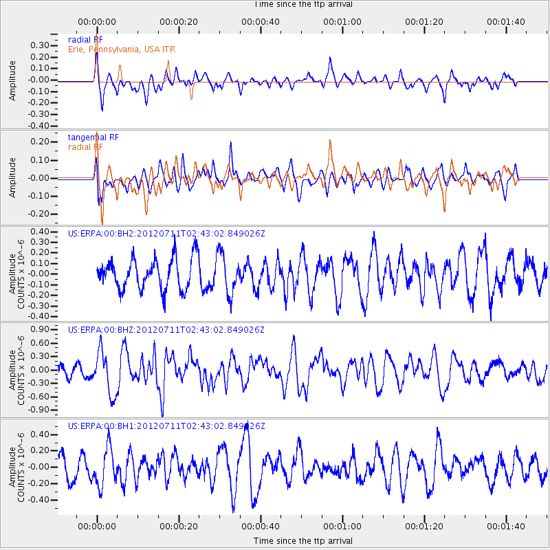
ERPA Erie, Pennsylvania, USA - Earthquake Result Viewer
*The percent match for this event was below the threshold and hence no stack was calculated.
| Earthquake location: |
Kuril Islands |
| Earthquake latitude/longitude: |
45.4/151.4 |
| Earthquake time(UTC): |
2012/07/11 (193) 02:31:16 GMT |
| Earthquake Depth: |
10 km |
| Earthquake Magnitude: |
5.6 MB, 5.5 MS, 5.7 MW, 5.7 MW |
| Earthquake Catalog/Contributor: |
WHDF/NEIC |
|
| Network: |
US United States National Seismic Network |
| Station: |
ERPA Erie, Pennsylvania, USA |
| Lat/Lon: |
42.12 N/79.99 W |
| Elevation: |
306 m |
|
| Distance: |
81.5 deg |
| Az: |
36.013 deg |
| Baz: |
326.167 deg |
| Ray Param: |
$rayparam |
*The percent match for this event was below the threshold and hence was not used in the summary stack. |
|
| Radial Match: |
65.3661 % |
| Radial Bump: |
400 |
| Transverse Match: |
64.39949 % |
| Transverse Bump: |
400 |
| SOD ConfigId: |
558545 |
| Insert Time: |
2013-09-19 22:01:06.717 +0000 |
| GWidth: |
2.5 |
| Max Bumps: |
400 |
| Tol: |
0.001 |
|
Signal To Noise
| Channel | StoN | STA | LTA |
| US:ERPA:00:BHZ:20120711T02:43:02.849026Z | 2.0063233 | 4.927137E-7 | 2.455804E-7 |
| US:ERPA:00:BH1:20120711T02:43:02.849026Z | 1.5112424 | 2.361735E-7 | 1.5627771E-7 |
| US:ERPA:00:BH2:20120711T02:43:02.849026Z | 1.3279186 | 1.9032481E-7 | 1.4332566E-7 |
| Arrivals |
| Ps | |
| PpPs | |
| PsPs/PpSs | |


