You are here: Home > Network List > US - United States National Seismic Network Stations List
> Station EGMT Eagleton, Montana, USA > Earthquake Result Viewer
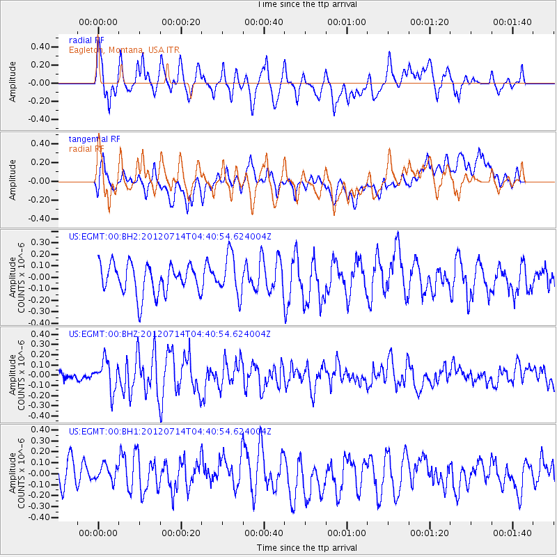
EGMT Eagleton, Montana, USA - Earthquake Result Viewer
*The percent match for this event was below the threshold and hence no stack was calculated.
| Earthquake location: |
Kuril Islands |
| Earthquake latitude/longitude: |
45.5/151.3 |
| Earthquake time(UTC): |
2012/07/14 (196) 04:30:58 GMT |
| Earthquake Depth: |
10 km |
| Earthquake Magnitude: |
5.5 MW |
| Earthquake Catalog/Contributor: |
NEIC PDE/NEIC PDE-M |
|
| Network: |
US United States National Seismic Network |
| Station: |
EGMT Eagleton, Montana, USA |
| Lat/Lon: |
48.02 N/109.75 W |
| Elevation: |
1055 m |
|
| Distance: |
63.0 deg |
| Az: |
48.09 deg |
| Baz: |
308.789 deg |
| Ray Param: |
$rayparam |
*The percent match for this event was below the threshold and hence was not used in the summary stack. |
|
| Radial Match: |
57.68259 % |
| Radial Bump: |
400 |
| Transverse Match: |
47.368645 % |
| Transverse Bump: |
400 |
| SOD ConfigId: |
558545 |
| Insert Time: |
2013-09-19 22:21:23.055 +0000 |
| GWidth: |
2.5 |
| Max Bumps: |
400 |
| Tol: |
0.001 |
|
Signal To Noise
| Channel | StoN | STA | LTA |
| US:EGMT:00:BHZ:20120714T04:40:54.624004Z | 3.4707499 | 1.5281005E-7 | 4.4027963E-8 |
| US:EGMT:00:BH1:20120714T04:40:54.624004Z | 0.730758 | 1.0425341E-7 | 1.4266476E-7 |
| US:EGMT:00:BH2:20120714T04:40:54.624004Z | 1.41542 | 1.80645E-7 | 1.2762644E-7 |
| Arrivals |
| Ps | |
| PpPs | |
| PsPs/PpSs | |


