You are here: Home > Network List > II - Global Seismograph Network (GSN - IRIS/IDA) Stations List
> Station KAPI Kappang, Sulawesi, Indonesia > Earthquake Result Viewer
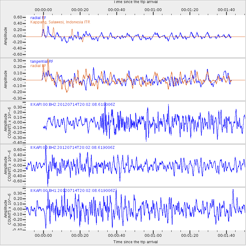
KAPI Kappang, Sulawesi, Indonesia - Earthquake Result Viewer
*The percent match for this event was below the threshold and hence no stack was calculated.
| Earthquake location: |
Myanmar-India Border Region |
| Earthquake latitude/longitude: |
25.4/94.5 |
| Earthquake time(UTC): |
2012/07/14 (196) 19:55:17 GMT |
| Earthquake Depth: |
52 km |
| Earthquake Magnitude: |
5.5 MB, 5.2 MW, 5.3 MW |
| Earthquake Catalog/Contributor: |
WHDF/NEIC |
|
| Network: |
II Global Seismograph Network (GSN - IRIS/IDA) |
| Station: |
KAPI Kappang, Sulawesi, Indonesia |
| Lat/Lon: |
5.01 S/119.75 E |
| Elevation: |
300 m |
|
| Distance: |
39.0 deg |
| Az: |
137.44 deg |
| Baz: |
322.126 deg |
| Ray Param: |
$rayparam |
*The percent match for this event was below the threshold and hence was not used in the summary stack. |
|
| Radial Match: |
58.209743 % |
| Radial Bump: |
400 |
| Transverse Match: |
53.331375 % |
| Transverse Bump: |
400 |
| SOD ConfigId: |
558545 |
| Insert Time: |
2013-09-19 22:22:48.535 +0000 |
| GWidth: |
2.5 |
| Max Bumps: |
400 |
| Tol: |
0.001 |
|
Signal To Noise
| Channel | StoN | STA | LTA |
| II:KAPI:00:BHZ:20120714T20:02:08.619006Z | 3.1554997 | 2.977167E-7 | 9.434851E-8 |
| II:KAPI:00:BH1:20120714T20:02:08.619006Z | 1.7828157 | 1.420581E-7 | 7.9681875E-8 |
| II:KAPI:00:BH2:20120714T20:02:08.619006Z | 1.7848519 | 1.337091E-7 | 7.4913274E-8 |
| Arrivals |
| Ps | |
| PpPs | |
| PsPs/PpSs | |


