You are here: Home > Network List > IU - Global Seismograph Network (GSN - IRIS/USGS) Stations List
> Station PMG Port Moresby, New Guinea > Earthquake Result Viewer
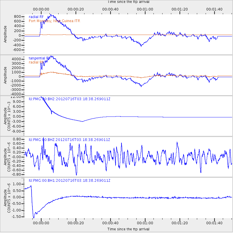
PMG Port Moresby, New Guinea - Earthquake Result Viewer
*The percent match for this event was below the threshold and hence no stack was calculated.
| Earthquake location: |
Near East Coast Of Kamchatka |
| Earthquake latitude/longitude: |
55.8/161.2 |
| Earthquake time(UTC): |
2012/07/16 (198) 03:08:31 GMT |
| Earthquake Depth: |
86 km |
| Earthquake Magnitude: |
5.5 MW, 5.5 MW |
| Earthquake Catalog/Contributor: |
NEIC PDE/NEIC PDE-M |
|
| Network: |
IU Global Seismograph Network (GSN - IRIS/USGS) |
| Station: |
PMG Port Moresby, New Guinea |
| Lat/Lon: |
9.40 S/147.16 E |
| Elevation: |
90 m |
|
| Distance: |
66.0 deg |
| Az: |
195.229 deg |
| Baz: |
8.65 deg |
| Ray Param: |
$rayparam |
*The percent match for this event was below the threshold and hence was not used in the summary stack. |
|
| Radial Match: |
40.64957 % |
| Radial Bump: |
400 |
| Transverse Match: |
40.646282 % |
| Transverse Bump: |
400 |
| SOD ConfigId: |
558545 |
| Insert Time: |
2013-09-19 22:25:10.736 +0000 |
| GWidth: |
2.5 |
| Max Bumps: |
400 |
| Tol: |
0.001 |
|
Signal To Noise
| Channel | StoN | STA | LTA |
| IU:PMG:00:BHZ:20120716T03:18:38.269011Z | 0.93666965 | 2.9245524E-7 | 3.122288E-7 |
| IU:PMG:00:BH1:20120716T03:18:38.269011Z | 1.5446098 | 1.099719E-6 | 7.1197206E-7 |
| IU:PMG:00:BH2:20120716T03:18:38.269011Z | 0.5367392 | 0.0022749188 | 0.0042384067 |
| Arrivals |
| Ps | |
| PpPs | |
| PsPs/PpSs | |


