You are here: Home > Network List > TA - USArray Transportable Network (new EarthScope stations) Stations List
> Station O48A Farmland, IN, USA > Earthquake Result Viewer
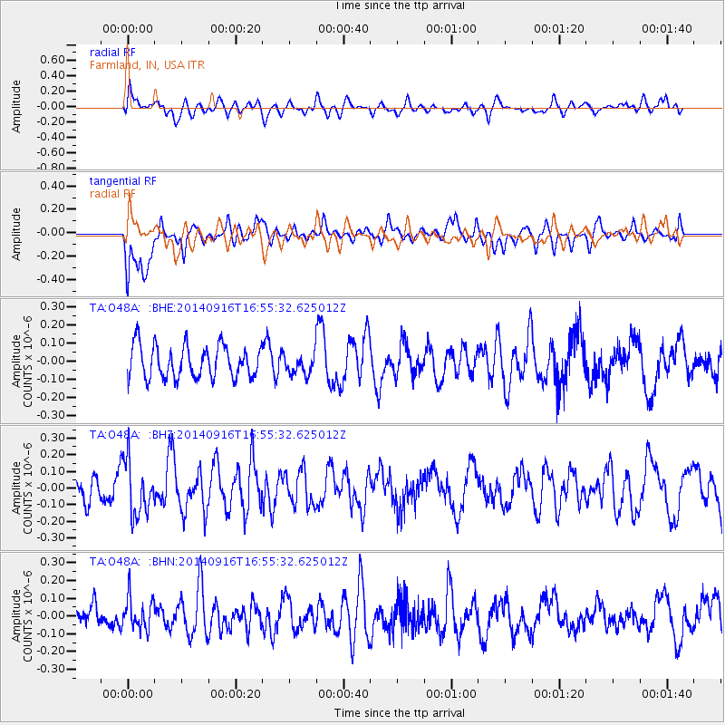
O48A Farmland, IN, USA - Earthquake Result Viewer
*The percent match for this event was below the threshold and hence no stack was calculated.
| Earthquake location: |
South Of Panama |
| Earthquake latitude/longitude: |
7.6/-82.4 |
| Earthquake time(UTC): |
2014/09/16 (259) 16:49:33 GMT |
| Earthquake Depth: |
25 km |
| Earthquake Magnitude: |
5.1 MW |
| Earthquake Catalog/Contributor: |
ISC/ISC |
|
| Network: |
TA USArray Transportable Network (new EarthScope stations) |
| Station: |
O48A Farmland, IN, USA |
| Lat/Lon: |
40.26 N/85.16 W |
| Elevation: |
300 m |
|
| Distance: |
32.6 deg |
| Az: |
356.052 deg |
| Baz: |
174.883 deg |
| Ray Param: |
$rayparam |
*The percent match for this event was below the threshold and hence was not used in the summary stack. |
|
| Radial Match: |
52.3187 % |
| Radial Bump: |
400 |
| Transverse Match: |
59.938232 % |
| Transverse Bump: |
400 |
| SOD ConfigId: |
3390531 |
| Insert Time: |
2019-04-14 02:19:24.027 +0000 |
| GWidth: |
2.5 |
| Max Bumps: |
400 |
| Tol: |
0.001 |
|
Signal To Noise
| Channel | StoN | STA | LTA |
| TA:O48A: :BHZ:20140916T16:55:32.625012Z | 2.4762821 | 1.6114575E-7 | 6.507568E-8 |
| TA:O48A: :BHN:20140916T16:55:32.625012Z | 1.0319312 | 9.229306E-8 | 8.943722E-8 |
| TA:O48A: :BHE:20140916T16:55:32.625012Z | 0.6074663 | 5.4398285E-8 | 8.9549474E-8 |
| Arrivals |
| Ps | |
| PpPs | |
| PsPs/PpSs | |


