You are here: Home > Network List > US - United States National Seismic Network Stations List
> Station DGMT Dagmar, Montana, USA > Earthquake Result Viewer
DGMT Dagmar, Montana, USA - Earthquake Result Viewer
*The percent match for this event was below the threshold and hence no stack was calculated.
| Earthquake location: |
Near East Coast Of Kamchatka |
| Earthquake latitude/longitude: |
55.8/161.2 |
| Earthquake time(UTC): |
2012/07/16 (198) 03:08:31 GMT |
| Earthquake Depth: |
86 km |
| Earthquake Magnitude: |
5.5 MW, 5.5 MW |
| Earthquake Catalog/Contributor: |
NEIC PDE/NEIC PDE-M |
|
| Network: |
US United States National Seismic Network |
| Station: |
DGMT Dagmar, Montana, USA |
| Lat/Lon: |
48.47 N/104.20 W |
| Elevation: |
0.0 m |
|
| Distance: |
54.1 deg |
| Az: |
54.944 deg |
| Baz: |
315.975 deg |
| Ray Param: |
$rayparam |
*The percent match for this event was below the threshold and hence was not used in the summary stack. |
|
| Radial Match: |
54.686825 % |
| Radial Bump: |
400 |
| Transverse Match: |
51.62414 % |
| Transverse Bump: |
400 |
| SOD ConfigId: |
558545 |
| Insert Time: |
2013-09-19 22:26:25.640 +0000 |
| GWidth: |
2.5 |
| Max Bumps: |
400 |
| Tol: |
0.001 |
|
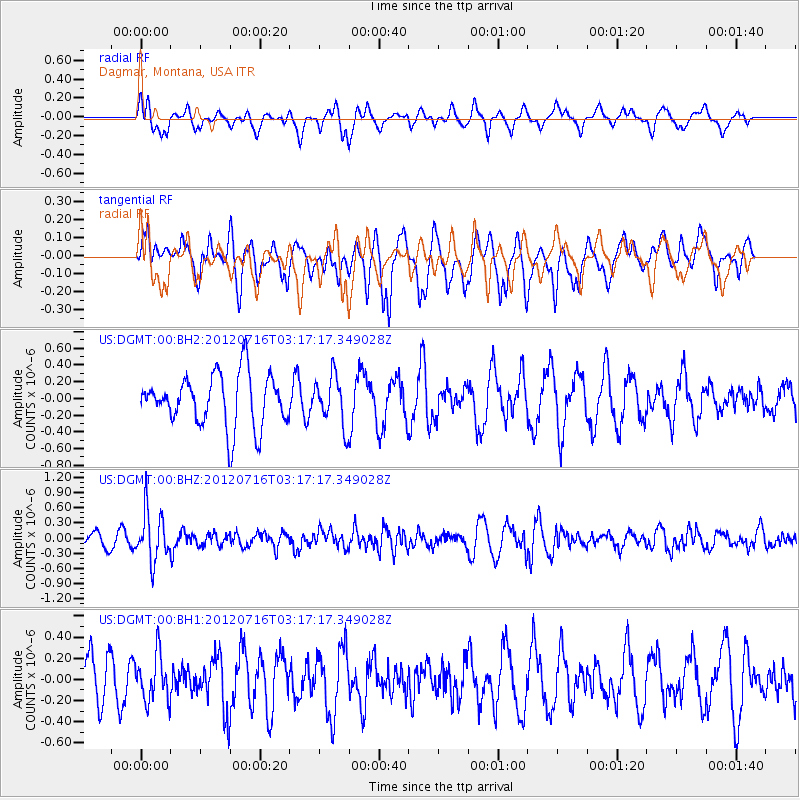
Signal To Noise
| Channel | StoN | STA | LTA |
| US:DGMT:00:BHZ:20120716T03:17:17.349028Z | 3.4579272 | 4.820228E-7 | 1.3939645E-7 |
| US:DGMT:00:BH1:20120716T03:17:17.349028Z | 1.3372632 | 2.1578191E-7 | 1.6136083E-7 |
| US:DGMT:00:BH2:20120716T03:17:17.349028Z | 0.94057786 | 2.938656E-7 | 3.1243093E-7 |
| Arrivals |
| Ps | |
| PpPs | |
| PsPs/PpSs | |


