You are here: Home > Network List > US - United States National Seismic Network Stations List
> Station EGMT Eagleton, Montana, USA > Earthquake Result Viewer
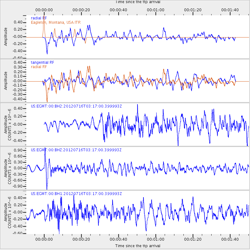
EGMT Eagleton, Montana, USA - Earthquake Result Viewer
*The percent match for this event was below the threshold and hence no stack was calculated.
| Earthquake location: |
Near East Coast Of Kamchatka |
| Earthquake latitude/longitude: |
55.8/161.2 |
| Earthquake time(UTC): |
2012/07/16 (198) 03:08:31 GMT |
| Earthquake Depth: |
86 km |
| Earthquake Magnitude: |
5.5 MW, 5.5 MW |
| Earthquake Catalog/Contributor: |
NEIC PDE/NEIC PDE-M |
|
| Network: |
US United States National Seismic Network |
| Station: |
EGMT Eagleton, Montana, USA |
| Lat/Lon: |
48.02 N/109.75 W |
| Elevation: |
1055 m |
|
| Distance: |
51.8 deg |
| Az: |
58.63 deg |
| Baz: |
314.059 deg |
| Ray Param: |
$rayparam |
*The percent match for this event was below the threshold and hence was not used in the summary stack. |
|
| Radial Match: |
67.93241 % |
| Radial Bump: |
400 |
| Transverse Match: |
57.892464 % |
| Transverse Bump: |
400 |
| SOD ConfigId: |
558545 |
| Insert Time: |
2013-09-19 22:26:34.575 +0000 |
| GWidth: |
2.5 |
| Max Bumps: |
400 |
| Tol: |
0.001 |
|
Signal To Noise
| Channel | StoN | STA | LTA |
| US:EGMT:00:BHZ:20120716T03:17:00.399993Z | 4.990185 | 4.319923E-7 | 8.65684E-8 |
| US:EGMT:00:BH1:20120716T03:17:00.399993Z | 0.9260705 | 1.4452887E-7 | 1.560668E-7 |
| US:EGMT:00:BH2:20120716T03:17:00.399993Z | 2.9489143 | 1.960224E-7 | 6.647274E-8 |
| Arrivals |
| Ps | |
| PpPs | |
| PsPs/PpSs | |


