You are here: Home > Network List > US - United States National Seismic Network Stations List
> Station WMOK Wichita Mountains, Oklahoma, USA > Earthquake Result Viewer
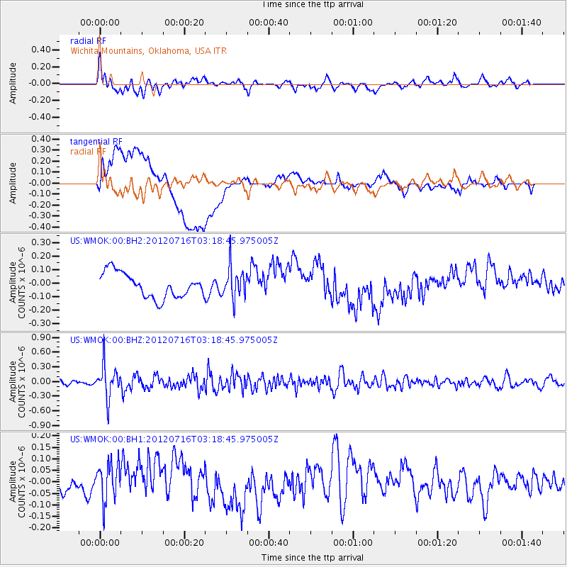
WMOK Wichita Mountains, Oklahoma, USA - Earthquake Result Viewer
*The percent match for this event was below the threshold and hence no stack was calculated.
| Earthquake location: |
Near East Coast Of Kamchatka |
| Earthquake latitude/longitude: |
55.8/161.2 |
| Earthquake time(UTC): |
2012/07/16 (198) 03:08:31 GMT |
| Earthquake Depth: |
86 km |
| Earthquake Magnitude: |
5.5 MW, 5.5 MW |
| Earthquake Catalog/Contributor: |
NEIC PDE/NEIC PDE-M |
|
| Network: |
US United States National Seismic Network |
| Station: |
WMOK Wichita Mountains, Oklahoma, USA |
| Lat/Lon: |
34.74 N/98.78 W |
| Elevation: |
486 m |
|
| Distance: |
67.2 deg |
| Az: |
61.613 deg |
| Baz: |
322.875 deg |
| Ray Param: |
$rayparam |
*The percent match for this event was below the threshold and hence was not used in the summary stack. |
|
| Radial Match: |
62.750027 % |
| Radial Bump: |
400 |
| Transverse Match: |
33.58838 % |
| Transverse Bump: |
400 |
| SOD ConfigId: |
558545 |
| Insert Time: |
2013-09-19 22:27:53.426 +0000 |
| GWidth: |
2.5 |
| Max Bumps: |
400 |
| Tol: |
0.001 |
|
Signal To Noise
| Channel | StoN | STA | LTA |
| US:WMOK:00:BHZ:20120716T03:18:45.975005Z | 6.190866 | 3.3887008E-7 | 5.4737107E-8 |
| US:WMOK:00:BH1:20120716T03:18:45.975005Z | 1.1957281 | 8.1589675E-8 | 6.8234314E-8 |
| US:WMOK:00:BH2:20120716T03:18:45.975005Z | 1.2940813 | 1.1732436E-7 | 9.0662276E-8 |
| Arrivals |
| Ps | |
| PpPs | |
| PsPs/PpSs | |


