You are here: Home > Network List > IU - Global Seismograph Network (GSN - IRIS/USGS) Stations List
> Station HNR Honiara, Solomon Islands > Earthquake Result Viewer
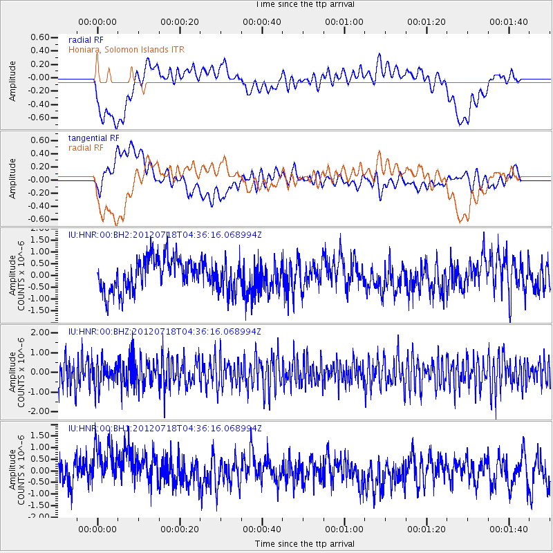
HNR Honiara, Solomon Islands - Earthquake Result Viewer
*The percent match for this event was below the threshold and hence no stack was calculated.
| Earthquake location: |
Pacific-Antarctic Ridge |
| Earthquake latitude/longitude: |
-55.7/-128.9 |
| Earthquake time(UTC): |
2012/07/18 (200) 04:25:25 GMT |
| Earthquake Depth: |
10 km |
| Earthquake Magnitude: |
5.9 MW, 5.5 MS, 5.8 MW |
| Earthquake Catalog/Contributor: |
NEIC PDE/NEIC PDE-M |
|
| Network: |
IU Global Seismograph Network (GSN - IRIS/USGS) |
| Station: |
HNR Honiara, Solomon Islands |
| Lat/Lon: |
9.44 S/159.95 E |
| Elevation: |
100 m |
|
| Distance: |
71.7 deg |
| Az: |
280.33 deg |
| Baz: |
145.595 deg |
| Ray Param: |
$rayparam |
*The percent match for this event was below the threshold and hence was not used in the summary stack. |
|
| Radial Match: |
33.21842 % |
| Radial Bump: |
400 |
| Transverse Match: |
45.527435 % |
| Transverse Bump: |
400 |
| SOD ConfigId: |
558545 |
| Insert Time: |
2013-09-19 22:30:18.451 +0000 |
| GWidth: |
2.5 |
| Max Bumps: |
400 |
| Tol: |
0.001 |
|
Signal To Noise
| Channel | StoN | STA | LTA |
| IU:HNR:00:BHZ:20120718T04:36:16.068994Z | 0.8481 | 5.9993346E-7 | 7.073853E-7 |
| IU:HNR:00:BH1:20120718T04:36:16.068994Z | 1.9465883 | 1.3022436E-6 | 6.689877E-7 |
| IU:HNR:00:BH2:20120718T04:36:16.068994Z | 0.9759516 | 6.7517635E-7 | 6.9181334E-7 |
| Arrivals |
| Ps | |
| PpPs | |
| PsPs/PpSs | |


