You are here: Home > Network List > II - Global Seismograph Network (GSN - IRIS/IDA) Stations List
> Station WRAB Tennant Creek, NT, Australia > Earthquake Result Viewer
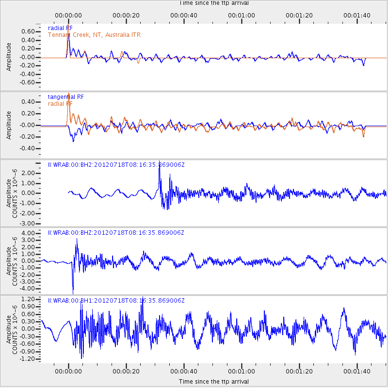
WRAB Tennant Creek, NT, Australia - Earthquake Result Viewer
*The percent match for this event was below the threshold and hence no stack was calculated.
| Earthquake location: |
Fiji Islands Region |
| Earthquake latitude/longitude: |
-20.9/-178.5 |
| Earthquake time(UTC): |
2012/07/18 (200) 08:09:46 GMT |
| Earthquake Depth: |
537 km |
| Earthquake Magnitude: |
5.5 MB, 5.9 MW, 6.0 MW |
| Earthquake Catalog/Contributor: |
WHDF/NEIC |
|
| Network: |
II Global Seismograph Network (GSN - IRIS/IDA) |
| Station: |
WRAB Tennant Creek, NT, Australia |
| Lat/Lon: |
19.93 S/134.36 E |
| Elevation: |
366 m |
|
| Distance: |
44.1 deg |
| Az: |
262.544 deg |
| Baz: |
99.737 deg |
| Ray Param: |
$rayparam |
*The percent match for this event was below the threshold and hence was not used in the summary stack. |
|
| Radial Match: |
47.13863 % |
| Radial Bump: |
400 |
| Transverse Match: |
58.492672 % |
| Transverse Bump: |
341 |
| SOD ConfigId: |
558545 |
| Insert Time: |
2013-09-19 22:32:11.281 +0000 |
| GWidth: |
2.5 |
| Max Bumps: |
400 |
| Tol: |
0.001 |
|
Signal To Noise
| Channel | StoN | STA | LTA |
| II:WRAB:00:BHZ:20120718T08:16:35.869006Z | 6.599679 | 1.4098914E-6 | 2.136303E-7 |
| II:WRAB:00:BH1:20120718T08:16:35.869006Z | 1.8752251 | 4.4709526E-7 | 2.384222E-7 |
| II:WRAB:00:BH2:20120718T08:16:35.869006Z | 3.8213234 | 9.793802E-7 | 2.5629348E-7 |
| Arrivals |
| Ps | |
| PpPs | |
| PsPs/PpSs | |


