You are here: Home > Network List > US - United States National Seismic Network Stations List
> Station EGMT Eagleton, Montana, USA > Earthquake Result Viewer
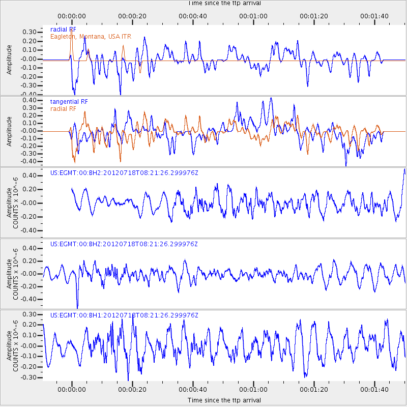
EGMT Eagleton, Montana, USA - Earthquake Result Viewer
*The percent match for this event was below the threshold and hence no stack was calculated.
| Earthquake location: |
Fiji Islands Region |
| Earthquake latitude/longitude: |
-20.9/-178.5 |
| Earthquake time(UTC): |
2012/07/18 (200) 08:09:46 GMT |
| Earthquake Depth: |
537 km |
| Earthquake Magnitude: |
5.5 MB, 5.9 MW, 6.0 MW |
| Earthquake Catalog/Contributor: |
WHDF/NEIC |
|
| Network: |
US United States National Seismic Network |
| Station: |
EGMT Eagleton, Montana, USA |
| Lat/Lon: |
48.02 N/109.75 W |
| Elevation: |
1055 m |
|
| Distance: |
92.0 deg |
| Az: |
38.76 deg |
| Baz: |
240.708 deg |
| Ray Param: |
$rayparam |
*The percent match for this event was below the threshold and hence was not used in the summary stack. |
|
| Radial Match: |
54.87519 % |
| Radial Bump: |
400 |
| Transverse Match: |
60.26024 % |
| Transverse Bump: |
400 |
| SOD ConfigId: |
558545 |
| Insert Time: |
2013-09-19 22:33:12.841 +0000 |
| GWidth: |
2.5 |
| Max Bumps: |
400 |
| Tol: |
0.001 |
|
Signal To Noise
| Channel | StoN | STA | LTA |
| US:EGMT:00:BHZ:20120718T08:21:26.299976Z | 2.2891014 | 1.6567641E-7 | 7.237618E-8 |
| US:EGMT:00:BH1:20120718T08:21:26.299976Z | 0.6587388 | 9.336991E-8 | 1.4174043E-7 |
| US:EGMT:00:BH2:20120718T08:21:26.299976Z | 1.5083076 | 1.3773435E-7 | 9.131715E-8 |
| Arrivals |
| Ps | |
| PpPs | |
| PsPs/PpSs | |


