You are here: Home > Network List > US - United States National Seismic Network Stations List
> Station WUAZ Wupatki, Arizona, USA > Earthquake Result Viewer
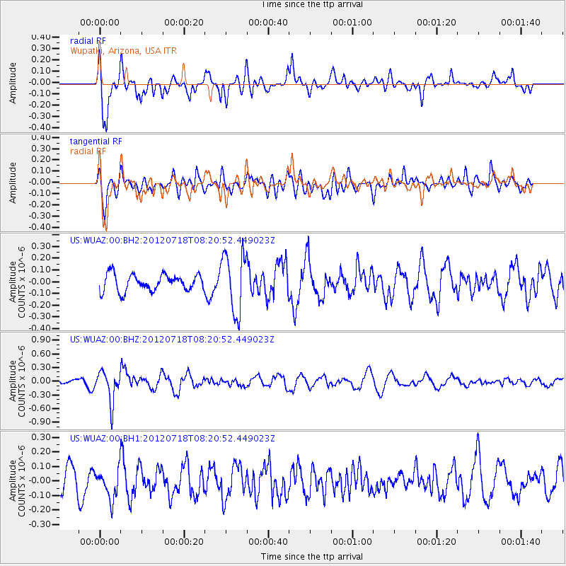
WUAZ Wupatki, Arizona, USA - Earthquake Result Viewer
*The percent match for this event was below the threshold and hence no stack was calculated.
| Earthquake location: |
Fiji Islands Region |
| Earthquake latitude/longitude: |
-20.9/-178.5 |
| Earthquake time(UTC): |
2012/07/18 (200) 08:09:46 GMT |
| Earthquake Depth: |
537 km |
| Earthquake Magnitude: |
5.5 MB, 5.9 MW, 6.0 MW |
| Earthquake Catalog/Contributor: |
WHDF/NEIC |
|
| Network: |
US United States National Seismic Network |
| Station: |
WUAZ Wupatki, Arizona, USA |
| Lat/Lon: |
35.52 N/111.37 W |
| Elevation: |
1592 m |
|
| Distance: |
84.7 deg |
| Az: |
49.012 deg |
| Baz: |
239.919 deg |
| Ray Param: |
$rayparam |
*The percent match for this event was below the threshold and hence was not used in the summary stack. |
|
| Radial Match: |
76.923065 % |
| Radial Bump: |
400 |
| Transverse Match: |
51.69744 % |
| Transverse Bump: |
400 |
| SOD ConfigId: |
558545 |
| Insert Time: |
2013-09-19 22:33:48.472 +0000 |
| GWidth: |
2.5 |
| Max Bumps: |
400 |
| Tol: |
0.001 |
|
Signal To Noise
| Channel | StoN | STA | LTA |
| US:WUAZ:00:BHZ:20120718T08:20:52.449023Z | 5.102086 | 3.480145E-7 | 6.821024E-8 |
| US:WUAZ:00:BH1:20120718T08:20:52.449023Z | 1.4285997 | 1.0656884E-7 | 7.4596706E-8 |
| US:WUAZ:00:BH2:20120718T08:20:52.449023Z | 3.646366 | 2.5827012E-7 | 7.082946E-8 |
| Arrivals |
| Ps | |
| PpPs | |
| PsPs/PpSs | |


