You are here: Home > Network List > US - United States National Seismic Network Stations List
> Station BLA Blacksburg, Virginia, USA > Earthquake Result Viewer
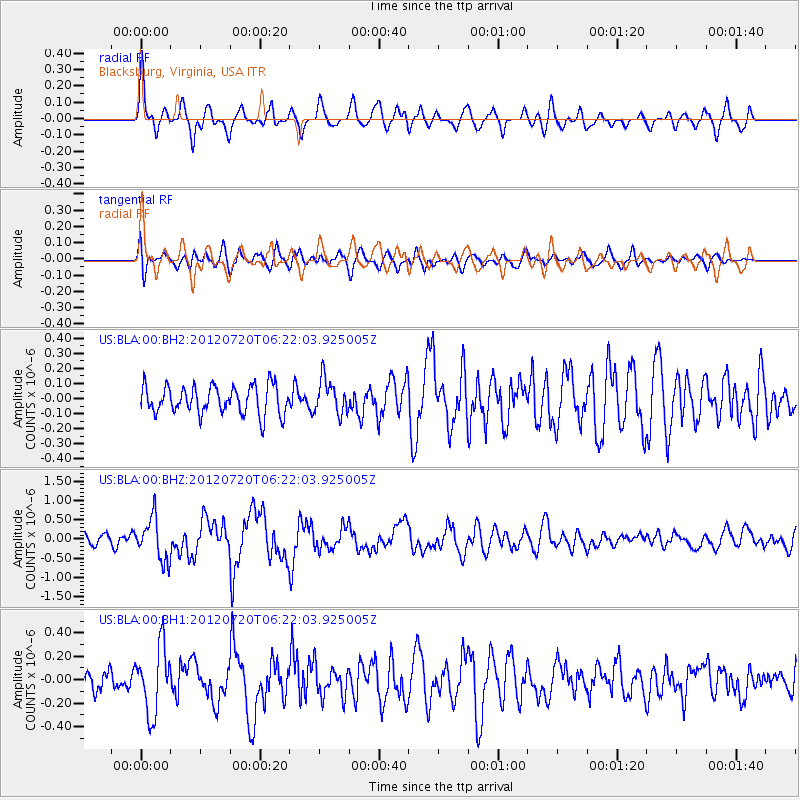
BLA Blacksburg, Virginia, USA - Earthquake Result Viewer
*The percent match for this event was below the threshold and hence no stack was calculated.
| Earthquake location: |
Kuril Islands |
| Earthquake latitude/longitude: |
49.4/155.9 |
| Earthquake time(UTC): |
2012/07/20 (202) 06:10:25 GMT |
| Earthquake Depth: |
19 km |
| Earthquake Magnitude: |
5.7 MB, 5.7 MS, 6.0 MW, 6.1 MW |
| Earthquake Catalog/Contributor: |
WHDF/NEIC |
|
| Network: |
US United States National Seismic Network |
| Station: |
BLA Blacksburg, Virginia, USA |
| Lat/Lon: |
37.21 N/80.42 W |
| Elevation: |
634 m |
|
| Distance: |
80.4 deg |
| Az: |
42.366 deg |
| Baz: |
326.541 deg |
| Ray Param: |
$rayparam |
*The percent match for this event was below the threshold and hence was not used in the summary stack. |
|
| Radial Match: |
74.24624 % |
| Radial Bump: |
400 |
| Transverse Match: |
65.579346 % |
| Transverse Bump: |
400 |
| SOD ConfigId: |
558545 |
| Insert Time: |
2013-09-19 22:38:36.325 +0000 |
| GWidth: |
2.5 |
| Max Bumps: |
400 |
| Tol: |
0.001 |
|
Signal To Noise
| Channel | StoN | STA | LTA |
| US:BLA:00:BHZ:20120720T06:22:03.925005Z | 4.5167966 | 5.5305696E-7 | 1.2244452E-7 |
| US:BLA:00:BH1:20120720T06:22:03.925005Z | 2.097068 | 2.839501E-7 | 1.3540338E-7 |
| US:BLA:00:BH2:20120720T06:22:03.925005Z | 1.2158489 | 1.13015226E-7 | 9.2951694E-8 |
| Arrivals |
| Ps | |
| PpPs | |
| PsPs/PpSs | |


