You are here: Home > Network List > US - United States National Seismic Network Stations List
> Station EYMN Ely, Minnesota, USA > Earthquake Result Viewer
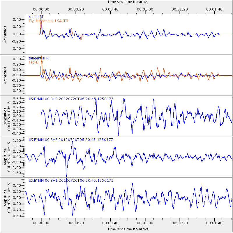
EYMN Ely, Minnesota, USA - Earthquake Result Viewer
*The percent match for this event was below the threshold and hence no stack was calculated.
| Earthquake location: |
Kuril Islands |
| Earthquake latitude/longitude: |
49.4/155.9 |
| Earthquake time(UTC): |
2012/07/20 (202) 06:10:25 GMT |
| Earthquake Depth: |
19 km |
| Earthquake Magnitude: |
5.7 MB, 5.7 MS, 6.0 MW, 6.1 MW |
| Earthquake Catalog/Contributor: |
WHDF/NEIC |
|
| Network: |
US United States National Seismic Network |
| Station: |
EYMN Ely, Minnesota, USA |
| Lat/Lon: |
47.95 N/91.50 W |
| Elevation: |
475 m |
|
| Distance: |
66.9 deg |
| Az: |
42.424 deg |
| Baz: |
319.047 deg |
| Ray Param: |
$rayparam |
*The percent match for this event was below the threshold and hence was not used in the summary stack. |
|
| Radial Match: |
64.92404 % |
| Radial Bump: |
400 |
| Transverse Match: |
59.039436 % |
| Transverse Bump: |
400 |
| SOD ConfigId: |
558545 |
| Insert Time: |
2013-09-19 22:39:06.245 +0000 |
| GWidth: |
2.5 |
| Max Bumps: |
400 |
| Tol: |
0.001 |
|
Signal To Noise
| Channel | StoN | STA | LTA |
| US:EYMN:00:BHZ:20120720T06:20:45.125017Z | 3.1552322 | 5.4832987E-7 | 1.7378433E-7 |
| US:EYMN:00:BH1:20120720T06:20:45.125017Z | 1.2884557 | 2.1769065E-7 | 1.689547E-7 |
| US:EYMN:00:BH2:20120720T06:20:45.125017Z | 1.5322762 | 2.0049232E-7 | 1.3084609E-7 |
| Arrivals |
| Ps | |
| PpPs | |
| PsPs/PpSs | |


