You are here: Home > Network List > US - United States National Seismic Network Stations List
> Station MIAR Mount Ida, Arkansas, USA > Earthquake Result Viewer
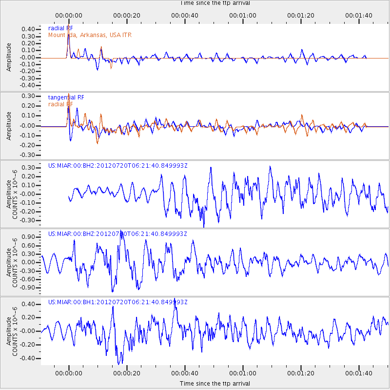
MIAR Mount Ida, Arkansas, USA - Earthquake Result Viewer
*The percent match for this event was below the threshold and hence no stack was calculated.
| Earthquake location: |
Kuril Islands |
| Earthquake latitude/longitude: |
49.4/155.9 |
| Earthquake time(UTC): |
2012/07/20 (202) 06:10:25 GMT |
| Earthquake Depth: |
19 km |
| Earthquake Magnitude: |
5.7 MB, 5.7 MS, 6.0 MW, 6.1 MW |
| Earthquake Catalog/Contributor: |
WHDF/NEIC |
|
| Network: |
US United States National Seismic Network |
| Station: |
MIAR Mount Ida, Arkansas, USA |
| Lat/Lon: |
34.55 N/93.58 W |
| Elevation: |
207 m |
|
| Distance: |
76.2 deg |
| Az: |
52.755 deg |
| Baz: |
320.955 deg |
| Ray Param: |
$rayparam |
*The percent match for this event was below the threshold and hence was not used in the summary stack. |
|
| Radial Match: |
63.19434 % |
| Radial Bump: |
400 |
| Transverse Match: |
50.066074 % |
| Transverse Bump: |
400 |
| SOD ConfigId: |
558545 |
| Insert Time: |
2013-09-19 22:39:42.939 +0000 |
| GWidth: |
2.5 |
| Max Bumps: |
400 |
| Tol: |
0.001 |
|
Signal To Noise
| Channel | StoN | STA | LTA |
| US:MIAR:00:BHZ:20120720T06:21:40.849993Z | 1.7834634 | 3.497513E-7 | 1.9610793E-7 |
| US:MIAR:00:BH1:20120720T06:21:40.849993Z | 0.8268102 | 1.0169103E-7 | 1.2299199E-7 |
| US:MIAR:00:BH2:20120720T06:21:40.849993Z | 2.5306246 | 1.3212946E-7 | 5.221219E-8 |
| Arrivals |
| Ps | |
| PpPs | |
| PsPs/PpSs | |


