You are here: Home > Network List > US - United States National Seismic Network Stations List
> Station PKME Peaks-Kenny State Park, Maine, USA > Earthquake Result Viewer
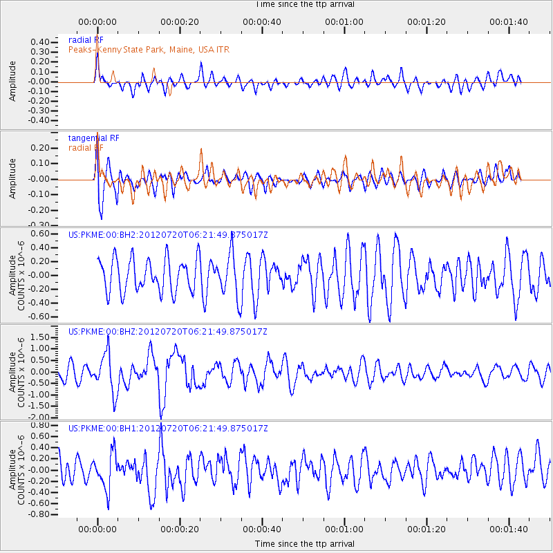
PKME Peaks-Kenny State Park, Maine, USA - Earthquake Result Viewer
*The percent match for this event was below the threshold and hence no stack was calculated.
| Earthquake location: |
Kuril Islands |
| Earthquake latitude/longitude: |
49.4/155.9 |
| Earthquake time(UTC): |
2012/07/20 (202) 06:10:25 GMT |
| Earthquake Depth: |
19 km |
| Earthquake Magnitude: |
5.7 MB, 5.7 MS, 6.0 MW, 6.1 MW |
| Earthquake Catalog/Contributor: |
WHDF/NEIC |
|
| Network: |
US United States National Seismic Network |
| Station: |
PKME Peaks-Kenny State Park, Maine, USA |
| Lat/Lon: |
45.26 N/69.29 W |
| Elevation: |
108 m |
|
| Distance: |
77.8 deg |
| Az: |
30.84 deg |
| Baz: |
331.695 deg |
| Ray Param: |
$rayparam |
*The percent match for this event was below the threshold and hence was not used in the summary stack. |
|
| Radial Match: |
54.97486 % |
| Radial Bump: |
400 |
| Transverse Match: |
63.20117 % |
| Transverse Bump: |
400 |
| SOD ConfigId: |
558545 |
| Insert Time: |
2013-09-19 22:40:03.547 +0000 |
| GWidth: |
2.5 |
| Max Bumps: |
400 |
| Tol: |
0.001 |
|
Signal To Noise
| Channel | StoN | STA | LTA |
| US:PKME:00:BHZ:20120720T06:21:49.875017Z | 3.4260867 | 8.827812E-7 | 2.5766457E-7 |
| US:PKME:00:BH1:20120720T06:21:49.875017Z | 1.7503936 | 3.2521996E-7 | 1.8579819E-7 |
| US:PKME:00:BH2:20120720T06:21:49.875017Z | 1.3969471 | 3.2884307E-7 | 2.3540122E-7 |
| Arrivals |
| Ps | |
| PpPs | |
| PsPs/PpSs | |


