You are here: Home > Network List > US - United States National Seismic Network Stations List
> Station VBMS Vicksburg, Mississippi > Earthquake Result Viewer
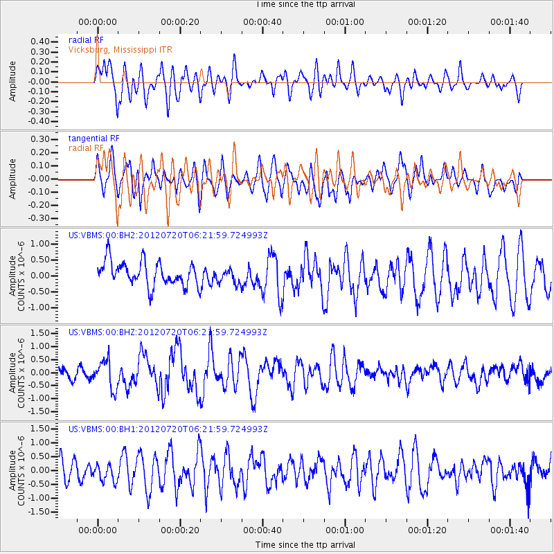
VBMS Vicksburg, Mississippi - Earthquake Result Viewer
*The percent match for this event was below the threshold and hence no stack was calculated.
| Earthquake location: |
Kuril Islands |
| Earthquake latitude/longitude: |
49.4/155.9 |
| Earthquake time(UTC): |
2012/07/20 (202) 06:10:25 GMT |
| Earthquake Depth: |
19 km |
| Earthquake Magnitude: |
5.7 MB, 5.7 MS, 6.0 MW, 6.1 MW |
| Earthquake Catalog/Contributor: |
WHDF/NEIC |
|
| Network: |
US United States National Seismic Network |
| Station: |
VBMS Vicksburg, Mississippi |
| Lat/Lon: |
32.22 N/90.52 W |
| Elevation: |
0.0 m |
|
| Distance: |
79.6 deg |
| Az: |
52.169 deg |
| Baz: |
322.508 deg |
| Ray Param: |
$rayparam |
*The percent match for this event was below the threshold and hence was not used in the summary stack. |
|
| Radial Match: |
52.08961 % |
| Radial Bump: |
400 |
| Transverse Match: |
52.95485 % |
| Transverse Bump: |
400 |
| SOD ConfigId: |
558545 |
| Insert Time: |
2013-09-19 22:40:17.719 +0000 |
| GWidth: |
2.5 |
| Max Bumps: |
400 |
| Tol: |
0.001 |
|
Signal To Noise
| Channel | StoN | STA | LTA |
| US:VBMS:00:BHZ:20120720T06:21:59.724993Z | 2.34051 | 5.6916787E-7 | 2.4318112E-7 |
| US:VBMS:00:BH1:20120720T06:21:59.724993Z | 0.7483811 | 3.1887865E-7 | 4.2609128E-7 |
| US:VBMS:00:BH2:20120720T06:21:59.724993Z | 0.64263076 | 2.431934E-7 | 3.784341E-7 |
| Arrivals |
| Ps | |
| PpPs | |
| PsPs/PpSs | |


