You are here: Home > Network List > US - United States National Seismic Network Stations List
> Station WMOK Wichita Mountains, Oklahoma, USA > Earthquake Result Viewer
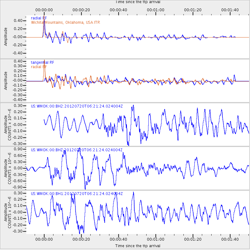
WMOK Wichita Mountains, Oklahoma, USA - Earthquake Result Viewer
*The percent match for this event was below the threshold and hence no stack was calculated.
| Earthquake location: |
Kuril Islands |
| Earthquake latitude/longitude: |
49.4/155.9 |
| Earthquake time(UTC): |
2012/07/20 (202) 06:10:25 GMT |
| Earthquake Depth: |
19 km |
| Earthquake Magnitude: |
5.7 MB, 5.7 MS, 6.0 MW, 6.1 MW |
| Earthquake Catalog/Contributor: |
WHDF/NEIC |
|
| Network: |
US United States National Seismic Network |
| Station: |
WMOK Wichita Mountains, Oklahoma, USA |
| Lat/Lon: |
34.74 N/98.78 W |
| Elevation: |
486 m |
|
| Distance: |
73.3 deg |
| Az: |
56.029 deg |
| Baz: |
318.87 deg |
| Ray Param: |
$rayparam |
*The percent match for this event was below the threshold and hence was not used in the summary stack. |
|
| Radial Match: |
75.62497 % |
| Radial Bump: |
400 |
| Transverse Match: |
54.803226 % |
| Transverse Bump: |
400 |
| SOD ConfigId: |
558545 |
| Insert Time: |
2013-09-19 22:40:19.427 +0000 |
| GWidth: |
2.5 |
| Max Bumps: |
400 |
| Tol: |
0.001 |
|
Signal To Noise
| Channel | StoN | STA | LTA |
| US:WMOK:00:BHZ:20120720T06:21:24.024004Z | 4.6146193 | 3.2867874E-7 | 7.1225536E-8 |
| US:WMOK:00:BH1:20120720T06:21:24.024004Z | 1.3320913 | 1.4241729E-7 | 1.0691256E-7 |
| US:WMOK:00:BH2:20120720T06:21:24.024004Z | 0.9510593 | 8.850613E-8 | 9.306058E-8 |
| Arrivals |
| Ps | |
| PpPs | |
| PsPs/PpSs | |


