You are here: Home > Network List > II - Global Seismograph Network (GSN - IRIS/IDA) Stations List
> Station CMLA Cha de Macela, Sao Miguel Island, Azores > Earthquake Result Viewer
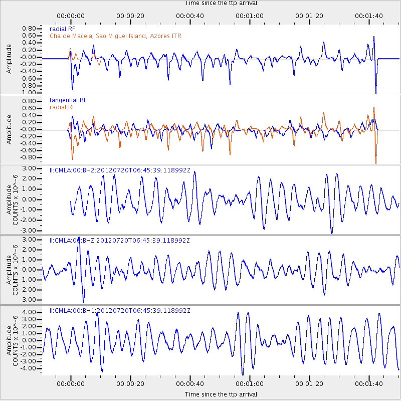
CMLA Cha de Macela, Sao Miguel Island, Azores - Earthquake Result Viewer
*The percent match for this event was below the threshold and hence no stack was calculated.
| Earthquake location: |
Kuril Islands |
| Earthquake latitude/longitude: |
49.4/156.1 |
| Earthquake time(UTC): |
2012/07/20 (202) 06:32:56 GMT |
| Earthquake Depth: |
10 km |
| Earthquake Magnitude: |
5.8 MB, 5.5 MS, 5.8 MW, 5.9 MW |
| Earthquake Catalog/Contributor: |
WHDF/NEIC |
|
| Network: |
II Global Seismograph Network (GSN - IRIS/IDA) |
| Station: |
CMLA Cha de Macela, Sao Miguel Island, Azores |
| Lat/Lon: |
37.76 N/25.52 W |
| Elevation: |
429 m |
|
| Distance: |
93.2 deg |
| Az: |
1.315 deg |
| Baz: |
358.915 deg |
| Ray Param: |
$rayparam |
*The percent match for this event was below the threshold and hence was not used in the summary stack. |
|
| Radial Match: |
44.333035 % |
| Radial Bump: |
400 |
| Transverse Match: |
47.139442 % |
| Transverse Bump: |
375 |
| SOD ConfigId: |
558545 |
| Insert Time: |
2013-09-19 22:41:08.709 +0000 |
| GWidth: |
2.5 |
| Max Bumps: |
400 |
| Tol: |
0.001 |
|
Signal To Noise
| Channel | StoN | STA | LTA |
| II:CMLA:00:BHZ:20120720T06:45:39.118992Z | 3.6246607 | 1.7201968E-6 | 4.7458144E-7 |
| II:CMLA:00:BH1:20120720T06:45:39.118992Z | 0.58978665 | 1.3640532E-6 | 2.312791E-6 |
| II:CMLA:00:BH2:20120720T06:45:39.118992Z | 0.93108284 | 1.1022593E-6 | 1.1838465E-6 |
| Arrivals |
| Ps | |
| PpPs | |
| PsPs/PpSs | |


