You are here: Home > Network List > US - United States National Seismic Network Stations List
> Station VBMS Vicksburg, Mississippi > Earthquake Result Viewer
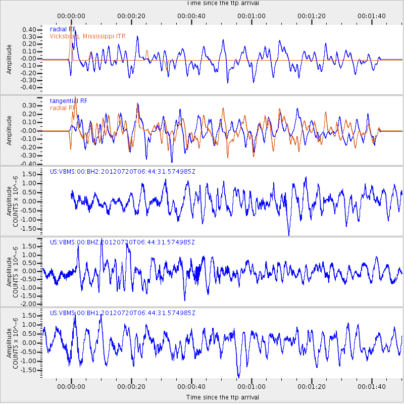
VBMS Vicksburg, Mississippi - Earthquake Result Viewer
*The percent match for this event was below the threshold and hence no stack was calculated.
| Earthquake location: |
Kuril Islands |
| Earthquake latitude/longitude: |
49.4/156.1 |
| Earthquake time(UTC): |
2012/07/20 (202) 06:32:56 GMT |
| Earthquake Depth: |
10 km |
| Earthquake Magnitude: |
5.8 MB, 5.5 MS, 5.8 MW, 5.9 MW |
| Earthquake Catalog/Contributor: |
WHDF/NEIC |
|
| Network: |
US United States National Seismic Network |
| Station: |
VBMS Vicksburg, Mississippi |
| Lat/Lon: |
32.22 N/90.52 W |
| Elevation: |
0.0 m |
|
| Distance: |
79.5 deg |
| Az: |
52.315 deg |
| Baz: |
322.373 deg |
| Ray Param: |
$rayparam |
*The percent match for this event was below the threshold and hence was not used in the summary stack. |
|
| Radial Match: |
53.41784 % |
| Radial Bump: |
400 |
| Transverse Match: |
44.96073 % |
| Transverse Bump: |
400 |
| SOD ConfigId: |
558545 |
| Insert Time: |
2013-09-19 22:43:33.259 +0000 |
| GWidth: |
2.5 |
| Max Bumps: |
400 |
| Tol: |
0.001 |
|
Signal To Noise
| Channel | StoN | STA | LTA |
| US:VBMS:00:BHZ:20120720T06:44:31.574985Z | 1.840584 | 5.61641E-7 | 3.051428E-7 |
| US:VBMS:00:BH1:20120720T06:44:31.574985Z | 1.7590724 | 8.001933E-7 | 4.5489503E-7 |
| US:VBMS:00:BH2:20120720T06:44:31.574985Z | 1.632367 | 5.4442944E-7 | 3.3352146E-7 |
| Arrivals |
| Ps | |
| PpPs | |
| PsPs/PpSs | |


