You are here: Home > Network List > US - United States National Seismic Network Stations List
> Station HAWA Hanford, Washington, USA > Earthquake Result Viewer
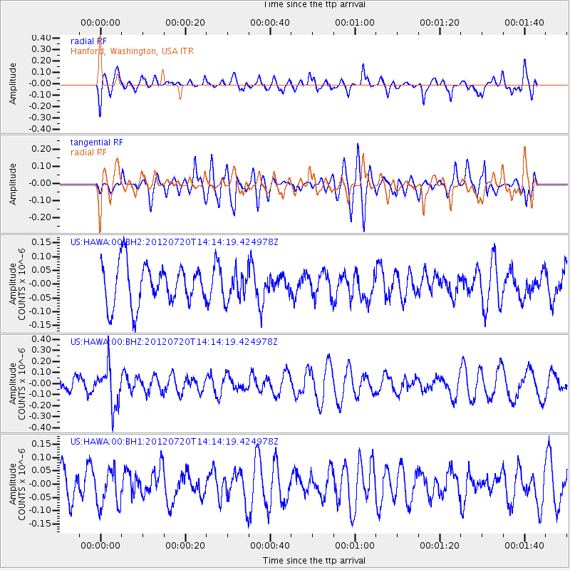
HAWA Hanford, Washington, USA - Earthquake Result Viewer
*The percent match for this event was below the threshold and hence no stack was calculated.
| Earthquake location: |
Fiji Islands Region |
| Earthquake latitude/longitude: |
-21.2/-179.3 |
| Earthquake time(UTC): |
2012/07/20 (202) 14:03:13 GMT |
| Earthquake Depth: |
625 km |
| Earthquake Magnitude: |
5.6 MB, 5.6 MW, 5.5 MW |
| Earthquake Catalog/Contributor: |
WHDF/NEIC |
|
| Network: |
US United States National Seismic Network |
| Station: |
HAWA Hanford, Washington, USA |
| Lat/Lon: |
46.39 N/119.53 W |
| Elevation: |
364 m |
|
| Distance: |
86.2 deg |
| Az: |
36.813 deg |
| Baz: |
233.875 deg |
| Ray Param: |
$rayparam |
*The percent match for this event was below the threshold and hence was not used in the summary stack. |
|
| Radial Match: |
53.016872 % |
| Radial Bump: |
400 |
| Transverse Match: |
64.80456 % |
| Transverse Bump: |
400 |
| SOD ConfigId: |
558545 |
| Insert Time: |
2013-09-19 22:45:09.691 +0000 |
| GWidth: |
2.5 |
| Max Bumps: |
400 |
| Tol: |
0.001 |
|
Signal To Noise
| Channel | StoN | STA | LTA |
| US:HAWA:00:BHZ:20120720T14:14:19.424978Z | 2.142085 | 1.801992E-7 | 8.4123265E-8 |
| US:HAWA:00:BH1:20120720T14:14:19.424978Z | 1.1150213 | 7.1206934E-8 | 6.38615E-8 |
| US:HAWA:00:BH2:20120720T14:14:19.424978Z | 0.7095146 | 5.2519617E-8 | 7.40219E-8 |
| Arrivals |
| Ps | |
| PpPs | |
| PsPs/PpSs | |


