You are here: Home > Network List > II - Global Seismograph Network (GSN - IRIS/IDA) Stations List
> Station WRAB Tennant Creek, NT, Australia > Earthquake Result Viewer
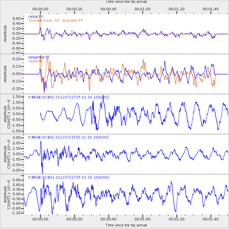
WRAB Tennant Creek, NT, Australia - Earthquake Result Viewer
*The percent match for this event was below the threshold and hence no stack was calculated.
| Earthquake location: |
East Of North Island, N.Z. |
| Earthquake latitude/longitude: |
-37.7/-180.0 |
| Earthquake time(UTC): |
2012/07/21 (203) 04:54:05 GMT |
| Earthquake Depth: |
12 km |
| Earthquake Magnitude: |
5.7 MB, 5.5 MS, 5.6 MW, 5.7 MW |
| Earthquake Catalog/Contributor: |
WHDF/NEIC |
|
| Network: |
II Global Seismograph Network (GSN - IRIS/IDA) |
| Station: |
WRAB Tennant Creek, NT, Australia |
| Lat/Lon: |
19.93 S/134.36 E |
| Elevation: |
366 m |
|
| Distance: |
43.3 deg |
| Az: |
281.07 deg |
| Baz: |
124.181 deg |
| Ray Param: |
$rayparam |
*The percent match for this event was below the threshold and hence was not used in the summary stack. |
|
| Radial Match: |
41.91903 % |
| Radial Bump: |
400 |
| Transverse Match: |
63.790234 % |
| Transverse Bump: |
400 |
| SOD ConfigId: |
558545 |
| Insert Time: |
2013-09-19 22:46:13.016 +0000 |
| GWidth: |
2.5 |
| Max Bumps: |
400 |
| Tol: |
0.001 |
|
Signal To Noise
| Channel | StoN | STA | LTA |
| II:WRAB:00:BHZ:20120721T05:01:36.169006Z | 2.2280507 | 1.1845657E-6 | 5.316601E-7 |
| II:WRAB:00:BH1:20120721T05:01:36.169006Z | 1.9263704 | 5.7248883E-7 | 2.9718524E-7 |
| II:WRAB:00:BH2:20120721T05:01:36.169006Z | 1.8162453 | 7.7301667E-7 | 4.2561246E-7 |
| Arrivals |
| Ps | |
| PpPs | |
| PsPs/PpSs | |


