You are here: Home > Network List > II - Global Seismograph Network (GSN - IRIS/IDA) Stations List
> Station TAU Hobart, Tasmania, Australia > Earthquake Result Viewer
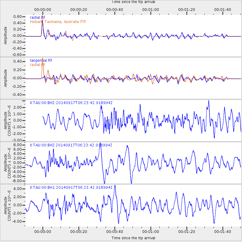
TAU Hobart, Tasmania, Australia - Earthquake Result Viewer
*The percent match for this event was below the threshold and hence no stack was calculated.
| Earthquake location: |
Mariana Islands |
| Earthquake latitude/longitude: |
13.8/144.4 |
| Earthquake time(UTC): |
2014/09/17 (260) 06:14:46 GMT |
| Earthquake Depth: |
137 km |
| Earthquake Magnitude: |
6.7 MWC, 7.1 MI |
| Earthquake Catalog/Contributor: |
NEIC PDE/NEIC COMCAT |
|
| Network: |
II Global Seismograph Network (GSN - IRIS/IDA) |
| Station: |
TAU Hobart, Tasmania, Australia |
| Lat/Lon: |
42.91 S/147.32 E |
| Elevation: |
132 m |
|
| Distance: |
56.4 deg |
| Az: |
177.423 deg |
| Baz: |
356.591 deg |
| Ray Param: |
$rayparam |
*The percent match for this event was below the threshold and hence was not used in the summary stack. |
|
| Radial Match: |
73.67893 % |
| Radial Bump: |
400 |
| Transverse Match: |
53.03228 % |
| Transverse Bump: |
400 |
| SOD ConfigId: |
3390531 |
| Insert Time: |
2019-04-14 02:29:21.255 +0000 |
| GWidth: |
2.5 |
| Max Bumps: |
400 |
| Tol: |
0.001 |
|
Signal To Noise
| Channel | StoN | STA | LTA |
| II:TAU:00:BHZ:20140917T06:23:42.918994Z | 2.6770158 | 2.7650751E-6 | 1.0328946E-6 |
| II:TAU:00:BH1:20140917T06:23:42.918994Z | 2.3810422 | 1.6307232E-6 | 6.848779E-7 |
| II:TAU:00:BH2:20140917T06:23:42.918994Z | 1.4155971 | 1.1407263E-6 | 8.0582697E-7 |
| Arrivals |
| Ps | |
| PpPs | |
| PsPs/PpSs | |


