GNI Garni, Armenia - Earthquake Result Viewer
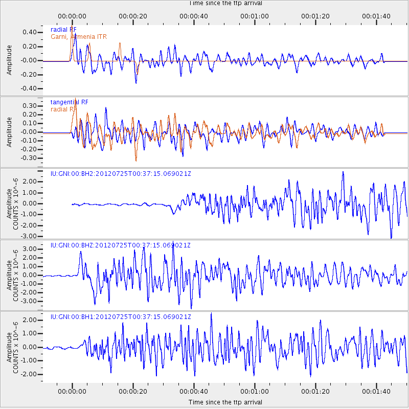
Earthquake location: Northern Sumatra, Indonesia
Earthquake latitude/longitude: 2.7/96.0
Earthquake time(UTC): 2012/07/25 (207) 00:27:45 GMT
Earthquake Depth: 22 km
Earthquake Magnitude: 5.9 MB, 6.5 MS, 6.4 MW, 6.3 MW
Earthquake Catalog/Contributor: WHDF/NEIC
Network: IU Global Seismograph Network (GSN - IRIS/USGS)
Station: GNI Garni, Armenia
Lat/Lon: 40.15 N/44.74 E
Elevation: 1609 m
Distance: 59.4 deg
Az: 315.979 deg
Baz: 115.095 deg
Ray Param: 0.06217517
Estimated Moho Depth: 32.5 km
Estimated Crust Vp/Vs: 2.09
Assumed Crust Vp: 6.291 km/s
Estimated Crust Vs: 3.014 km/s
Estimated Crust Poisson's Ratio: 0.35
Radial Match: 81.581825 %
Radial Bump: 400
Transverse Match: 79.13739 %
Transverse Bump: 400
SOD ConfigId: 558545
Insert Time: 2013-09-19 22:50:58.687 +0000
GWidth: 2.5
Max Bumps: 400
Tol: 0.001

Signal To Noise

ChannelStoNSTALTA
IU:GNI:00:BHZ:20120725T00:37:15.069021Z14.2464961.0639058E-67.467841E-8
IU:GNI:00:BH1:20120725T00:37:15.069021Z3.2180242.2028372E-76.84531E-8
IU:GNI:00:BH2:20120725T00:37:15.069021Z6.88034533.831206E-75.568334E-8
Arrivals
Ps5.8 SECOND
PpPs15 SECOND
PsPs/PpSs21 SECOND