You are here: Home > Network List > IU - Global Seismograph Network (GSN - IRIS/USGS) Stations List
> Station HNR Honiara, Solomon Islands > Earthquake Result Viewer
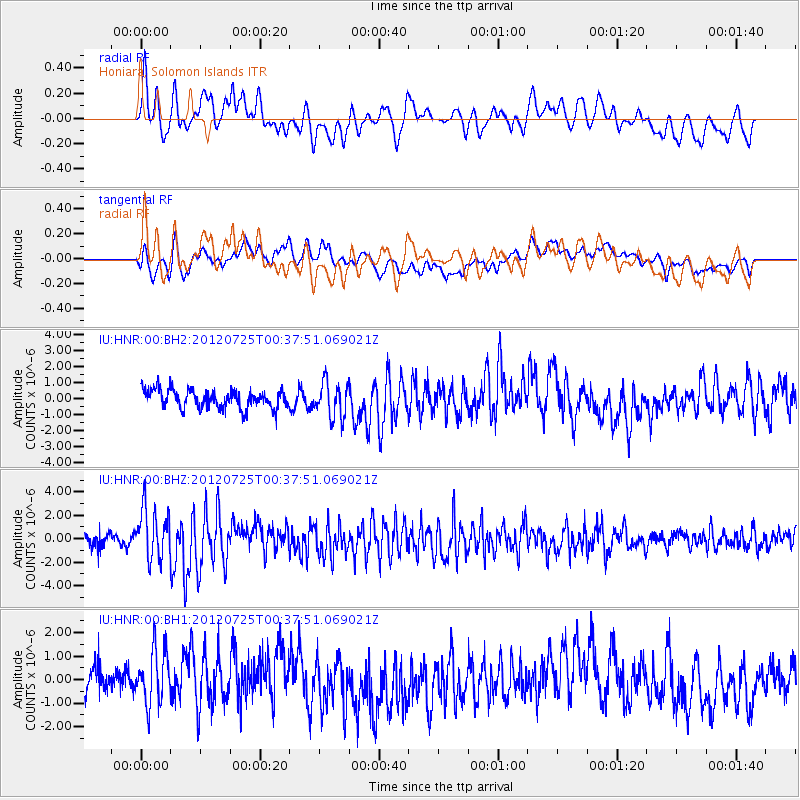
HNR Honiara, Solomon Islands - Earthquake Result Viewer
*The percent match for this event was below the threshold and hence no stack was calculated.
| Earthquake location: |
Northern Sumatra, Indonesia |
| Earthquake latitude/longitude: |
2.7/96.0 |
| Earthquake time(UTC): |
2012/07/25 (207) 00:27:45 GMT |
| Earthquake Depth: |
22 km |
| Earthquake Magnitude: |
5.9 MB, 6.5 MS, 6.4 MW, 6.3 MW |
| Earthquake Catalog/Contributor: |
WHDF/NEIC |
|
| Network: |
IU Global Seismograph Network (GSN - IRIS/USGS) |
| Station: |
HNR Honiara, Solomon Islands |
| Lat/Lon: |
9.44 S/159.95 E |
| Elevation: |
100 m |
|
| Distance: |
64.8 deg |
| Az: |
101.676 deg |
| Baz: |
277.486 deg |
| Ray Param: |
$rayparam |
*The percent match for this event was below the threshold and hence was not used in the summary stack. |
|
| Radial Match: |
66.54295 % |
| Radial Bump: |
400 |
| Transverse Match: |
60.69753 % |
| Transverse Bump: |
400 |
| SOD ConfigId: |
558545 |
| Insert Time: |
2013-09-19 22:51:06.835 +0000 |
| GWidth: |
2.5 |
| Max Bumps: |
400 |
| Tol: |
0.001 |
|
Signal To Noise
| Channel | StoN | STA | LTA |
| IU:HNR:00:BHZ:20120725T00:37:51.069021Z | 4.8753557 | 2.1706971E-6 | 4.4523873E-7 |
| IU:HNR:00:BH1:20120725T00:37:51.069021Z | 1.9238441 | 1.1913967E-6 | 6.192792E-7 |
| IU:HNR:00:BH2:20120725T00:37:51.069021Z | 1.8399003 | 1.0841748E-6 | 5.8925735E-7 |
| Arrivals |
| Ps | |
| PpPs | |
| PsPs/PpSs | |


