
MAJO Matsushiro, Japan - Earthquake Result Viewer
| ||||||||||||||||||
| ||||||||||||||||||
| ||||||||||||||||||
|
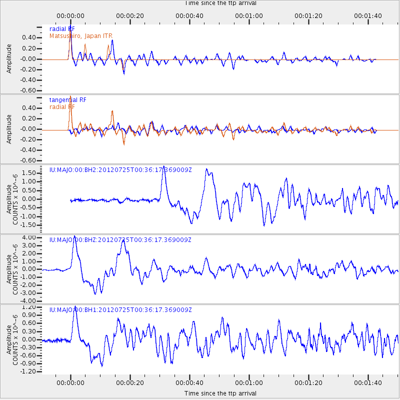
Signal To Noise
| Channel | StoN | STA | LTA |
| IU:MAJO:00:BHZ:20120725T00:36:17.369009Z | 49.92794 | 2.0614268E-6 | 4.1288043E-8 |
| IU:MAJO:00:BH1:20120725T00:36:17.369009Z | 10.951435 | 5.6866935E-7 | 5.1926467E-8 |
| IU:MAJO:00:BH2:20120725T00:36:17.369009Z | 16.42923 | 8.5455275E-7 | 5.201417E-8 |
| Arrivals | |
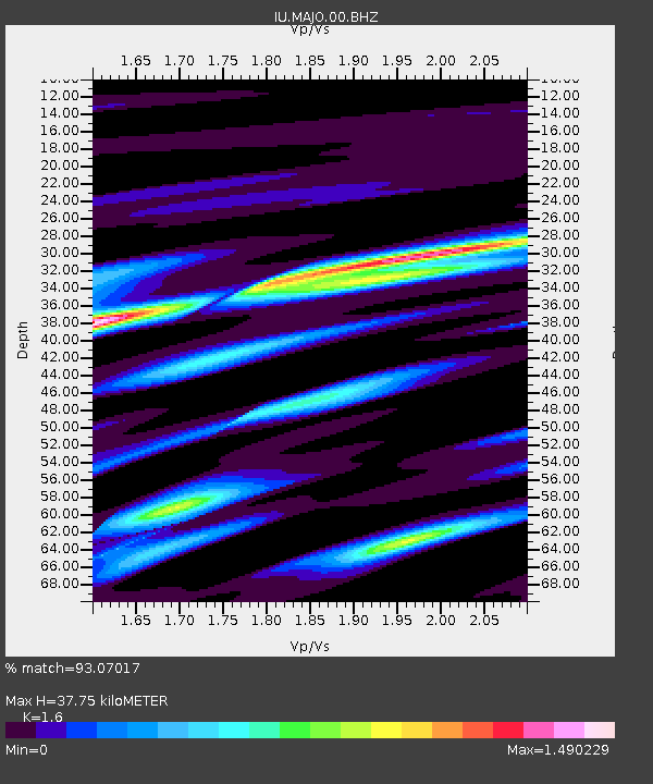
| Ps | 3.7 SECOND |
| PpPs | 14 SECOND |
| PsPs/PpSs | 18 SECOND |

