PSAA1 Pilbara Seismic Array Element A1 - Earthquake Result Viewer
Earthquake location: Solomon Islands
Earthquake latitude/longitude: -9.7/159.7
Earthquake time(UTC): 2012/07/25 (207) 11:20:27 GMT
Earthquake Depth: 20 km
Earthquake Magnitude: 6.4 MB, 6.5 MS, 6.4 MW, 6.3 MW
Earthquake Catalog/Contributor: WHDF/NEIC
Network: AU Australian Seismological Centre
Station: PSAA1 Pilbara Seismic Array Element A1
Lat/Lon: 21.58 S/119.84 E
Elevation: 325 m
Distance: 40.1 deg
Az: 248.015 deg
Baz: 79.178 deg
Ray Param: 0.07457929
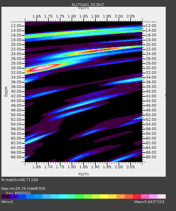
Estimated Moho Depth: 29.25 km
Estimated Crust Vp/Vs: 1.69
Assumed Crust Vp: 6.464 km/s
Estimated Crust Vs: 3.836 km/s
Estimated Crust Poisson's Ratio: 0.23
Radial Match: 88.71326 %
Radial Bump: 383
Transverse Match: 65.42635 %
Transverse Bump: 400
SOD ConfigId: 558545
Insert Time: 2013-09-19 22:52:25.025 +0000
GWidth: 2.5
Max Bumps: 400
Tol: 0.001

Signal To Noise

ChannelStoNSTALTA
AU:PSAA1:00:BHZ:20120725T11:27:30.169008Z1.91836629.729985E-75.072016E-7
AU:PSAA1:00:BH1:20120725T11:27:30.169008Z1.17620962.749889E-72.3379243E-7
AU:PSAA1:00:BH2:20120725T11:27:30.169008Z1.6371377.096352E-74.3346108E-7
Arrivals
Ps3.3 SECOND
PpPs11 SECOND
PsPs/PpSs15 SECOND