You are here: Home > Network List > US - United States National Seismic Network Stations List
> Station MSO Missoula, Montana, USA > Earthquake Result Viewer
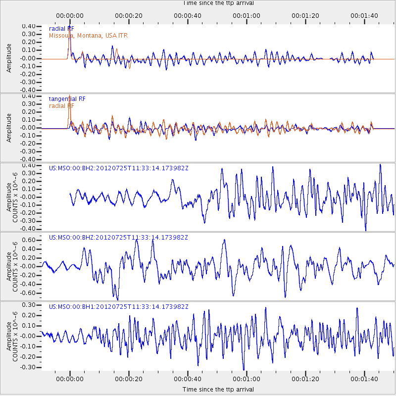
MSO Missoula, Montana, USA - Earthquake Result Viewer
*The percent match for this event was below the threshold and hence no stack was calculated.
| Earthquake location: |
Solomon Islands |
| Earthquake latitude/longitude: |
-9.7/159.7 |
| Earthquake time(UTC): |
2012/07/25 (207) 11:20:27 GMT |
| Earthquake Depth: |
20 km |
| Earthquake Magnitude: |
6.4 MB, 6.5 MS, 6.4 MW, 6.3 MW |
| Earthquake Catalog/Contributor: |
WHDF/NEIC |
|
| Network: |
US United States National Seismic Network |
| Station: |
MSO Missoula, Montana, USA |
| Lat/Lon: |
46.83 N/113.94 W |
| Elevation: |
1264 m |
|
| Distance: |
94.5 deg |
| Az: |
43.419 deg |
| Baz: |
260.723 deg |
| Ray Param: |
$rayparam |
*The percent match for this event was below the threshold and hence was not used in the summary stack. |
|
| Radial Match: |
61.740585 % |
| Radial Bump: |
400 |
| Transverse Match: |
61.56291 % |
| Transverse Bump: |
400 |
| SOD ConfigId: |
558545 |
| Insert Time: |
2013-09-19 22:54:04.565 +0000 |
| GWidth: |
2.5 |
| Max Bumps: |
400 |
| Tol: |
0.001 |
|
Signal To Noise
| Channel | StoN | STA | LTA |
| US:MSO:00:BHZ:20120725T11:33:14.173982Z | 2.2428677 | 1.364624E-7 | 6.084282E-8 |
| US:MSO:00:BH1:20120725T11:33:14.173982Z | 1.0002291 | 4.07877E-8 | 4.0778357E-8 |
| US:MSO:00:BH2:20120725T11:33:14.173982Z | 1.4281461 | 7.3611005E-8 | 5.154305E-8 |
| Arrivals |
| Ps | |
| PpPs | |
| PsPs/PpSs | |


