You are here: Home > Network List > US - United States National Seismic Network Stations List
> Station MVCO Mesa Verde, Colorado, USA > Earthquake Result Viewer
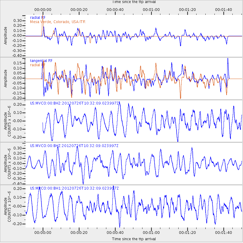
MVCO Mesa Verde, Colorado, USA - Earthquake Result Viewer
*The percent match for this event was below the threshold and hence no stack was calculated.
| Earthquake location: |
Tonga Islands |
| Earthquake latitude/longitude: |
-21.0/-174.5 |
| Earthquake time(UTC): |
2012/07/26 (208) 10:20:05 GMT |
| Earthquake Depth: |
10 km |
| Earthquake Magnitude: |
5.5 MW, 5.3 MS, 5.4 MB, 5.6 MW |
| Earthquake Catalog/Contributor: |
WHDF/NEIC |
|
| Network: |
US United States National Seismic Network |
| Station: |
MVCO Mesa Verde, Colorado, USA |
| Lat/Lon: |
37.21 N/108.50 W |
| Elevation: |
2170 m |
|
| Distance: |
84.9 deg |
| Az: |
47.071 deg |
| Baz: |
238.965 deg |
| Ray Param: |
$rayparam |
*The percent match for this event was below the threshold and hence was not used in the summary stack. |
|
| Radial Match: |
48.619144 % |
| Radial Bump: |
400 |
| Transverse Match: |
39.999603 % |
| Transverse Bump: |
400 |
| SOD ConfigId: |
558545 |
| Insert Time: |
2013-09-19 22:57:09.883 +0000 |
| GWidth: |
2.5 |
| Max Bumps: |
400 |
| Tol: |
0.001 |
|
Signal To Noise
| Channel | StoN | STA | LTA |
| US:MVCO:00:BHZ:20120726T10:32:09.023997Z | 2.5678637 | 1.6856599E-7 | 6.564444E-8 |
| US:MVCO:00:BH1:20120726T10:32:09.023997Z | 1.293618 | 9.692928E-8 | 7.492883E-8 |
| US:MVCO:00:BH2:20120726T10:32:09.023997Z | 1.1980814 | 1.12969E-7 | 9.4291586E-8 |
| Arrivals |
| Ps | |
| PpPs | |
| PsPs/PpSs | |


