You are here: Home > Network List > IU - Global Seismograph Network (GSN - IRIS/USGS) Stations List
> Station JOHN Johnston Island, USA > Earthquake Result Viewer
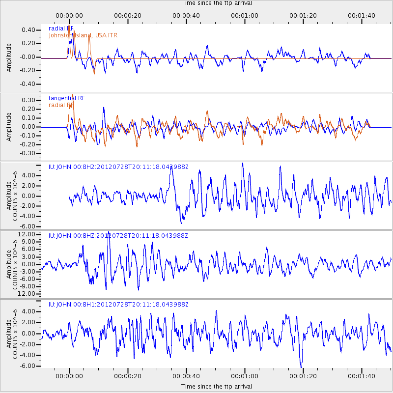
JOHN Johnston Island, USA - Earthquake Result Viewer
*The percent match for this event was below the threshold and hence no stack was calculated.
| Earthquake location: |
New Ireland Region, P.N.G. |
| Earthquake latitude/longitude: |
-4.7/153.2 |
| Earthquake time(UTC): |
2012/07/28 (210) 20:03:56 GMT |
| Earthquake Depth: |
41 km |
| Earthquake Magnitude: |
6.1 MB, 6.3 MS, 6.5 MW, 6.5 MW |
| Earthquake Catalog/Contributor: |
WHDF/NEIC |
|
| Network: |
IU Global Seismograph Network (GSN - IRIS/USGS) |
| Station: |
JOHN Johnston Island, USA |
| Lat/Lon: |
16.73 N/169.53 W |
| Elevation: |
2.0 m |
|
| Distance: |
42.5 deg |
| Az: |
59.165 deg |
| Baz: |
243.278 deg |
| Ray Param: |
$rayparam |
*The percent match for this event was below the threshold and hence was not used in the summary stack. |
|
| Radial Match: |
73.70757 % |
| Radial Bump: |
400 |
| Transverse Match: |
67.83219 % |
| Transverse Bump: |
400 |
| SOD ConfigId: |
558545 |
| Insert Time: |
2013-09-19 23:00:19.248 +0000 |
| GWidth: |
2.5 |
| Max Bumps: |
400 |
| Tol: |
0.001 |
|
Signal To Noise
| Channel | StoN | STA | LTA |
| IU:JOHN:00:BHZ:20120728T20:11:18.043988Z | 2.7986324 | 2.7596075E-6 | 9.860557E-7 |
| IU:JOHN:00:BH1:20120728T20:11:18.043988Z | 1.3360459 | 1.4182124E-6 | 1.0614998E-6 |
| IU:JOHN:00:BH2:20120728T20:11:18.043988Z | 2.1761987 | 1.8589104E-6 | 8.5420066E-7 |
| Arrivals |
| Ps | |
| PpPs | |
| PsPs/PpSs | |


