You are here: Home > Network List > US - United States National Seismic Network Stations List
> Station BOZ Bozeman, Montana, USA > Earthquake Result Viewer
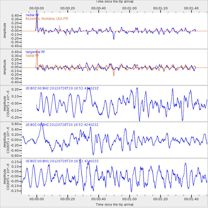
BOZ Bozeman, Montana, USA - Earthquake Result Viewer
*The percent match for this event was below the threshold and hence no stack was calculated.
| Earthquake location: |
New Ireland Region, P.N.G. |
| Earthquake latitude/longitude: |
-4.7/153.2 |
| Earthquake time(UTC): |
2012/07/28 (210) 20:03:56 GMT |
| Earthquake Depth: |
41 km |
| Earthquake Magnitude: |
6.1 MB, 6.3 MS, 6.5 MW, 6.5 MW |
| Earthquake Catalog/Contributor: |
WHDF/NEIC |
|
| Network: |
US United States National Seismic Network |
| Station: |
BOZ Bozeman, Montana, USA |
| Lat/Lon: |
45.65 N/111.63 W |
| Elevation: |
1589 m |
|
| Distance: |
96.9 deg |
| Az: |
44.728 deg |
| Baz: |
270.453 deg |
| Ray Param: |
$rayparam |
*The percent match for this event was below the threshold and hence was not used in the summary stack. |
|
| Radial Match: |
71.705475 % |
| Radial Bump: |
400 |
| Transverse Match: |
51.840755 % |
| Transverse Bump: |
400 |
| SOD ConfigId: |
558545 |
| Insert Time: |
2013-09-19 23:01:04.219 +0000 |
| GWidth: |
2.5 |
| Max Bumps: |
400 |
| Tol: |
0.001 |
|
Signal To Noise
| Channel | StoN | STA | LTA |
| US:BOZ:00:BHZ:20120728T20:16:52.424023Z | 4.517045 | 3.6822917E-7 | 8.151992E-8 |
| US:BOZ:00:BH1:20120728T20:16:52.424023Z | 1.2071508 | 6.9951106E-8 | 5.794728E-8 |
| US:BOZ:00:BH2:20120728T20:16:52.424023Z | 1.5986567 | 1.4845284E-7 | 9.2860994E-8 |
| Arrivals |
| Ps | |
| PpPs | |
| PsPs/PpSs | |


