You are here: Home > Network List > US - United States National Seismic Network Stations List
> Station EGMT Eagleton, Montana, USA > Earthquake Result Viewer
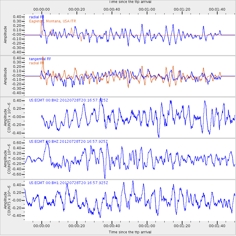
EGMT Eagleton, Montana, USA - Earthquake Result Viewer
*The percent match for this event was below the threshold and hence no stack was calculated.
| Earthquake location: |
New Ireland Region, P.N.G. |
| Earthquake latitude/longitude: |
-4.7/153.2 |
| Earthquake time(UTC): |
2012/07/28 (210) 20:03:56 GMT |
| Earthquake Depth: |
41 km |
| Earthquake Magnitude: |
6.1 MB, 6.3 MS, 6.5 MW, 6.5 MW |
| Earthquake Catalog/Contributor: |
WHDF/NEIC |
|
| Network: |
US United States National Seismic Network |
| Station: |
EGMT Eagleton, Montana, USA |
| Lat/Lon: |
48.02 N/109.75 W |
| Elevation: |
1055 m |
|
| Distance: |
98.2 deg |
| Az: |
42.301 deg |
| Baz: |
272.136 deg |
| Ray Param: |
$rayparam |
*The percent match for this event was below the threshold and hence was not used in the summary stack. |
|
| Radial Match: |
63.92889 % |
| Radial Bump: |
400 |
| Transverse Match: |
53.185646 % |
| Transverse Bump: |
392 |
| SOD ConfigId: |
558545 |
| Insert Time: |
2013-09-19 23:01:14.112 +0000 |
| GWidth: |
2.5 |
| Max Bumps: |
400 |
| Tol: |
0.001 |
|
Signal To Noise
| Channel | StoN | STA | LTA |
| US:EGMT:00:BHZ:20120728T20:16:57.925Z | 4.1202927 | 3.5786303E-7 | 8.6853795E-8 |
| US:EGMT:00:BH1:20120728T20:16:57.925Z | 1.12348 | 1.9277432E-7 | 1.7158679E-7 |
| US:EGMT:00:BH2:20120728T20:16:57.925Z | 1.8440349 | 2.8959786E-7 | 1.5704575E-7 |
| Arrivals |
| Ps | |
| PpPs | |
| PsPs/PpSs | |


