You are here: Home > Network List > US - United States National Seismic Network Stations List
> Station WRAK Wrangell Island, Southeastern Alaska, Alaska, USA > Earthquake Result Viewer
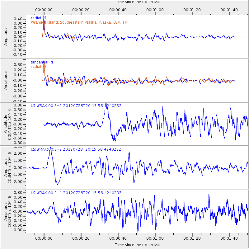
WRAK Wrangell Island, Southeastern Alaska, Alaska, USA - Earthquake Result Viewer

| Earthquake location: |
New Ireland Region, P.N.G. |
| Earthquake latitude/longitude: |
-4.7/153.2 |
| Earthquake time(UTC): |
2012/07/28 (210) 20:03:56 GMT |
| Earthquake Depth: |
41 km |
| Earthquake Magnitude: |
6.1 MB, 6.3 MS, 6.5 MW, 6.5 MW |
| Earthquake Catalog/Contributor: |
WHDF/NEIC |
|
| Network: |
US United States National Seismic Network |
| Station: |
WRAK Wrangell Island, Southeastern Alaska, Alaska, USA |
| Lat/Lon: |
56.42 N/132.35 W |
| Elevation: |
81 m |
|
| Distance: |
85.3 deg |
| Az: |
32.494 deg |
| Baz: |
254.492 deg |
| Ray Param: |
0.044772074 |
| Estimated Moho Depth: |
69.75 km |
| Estimated Crust Vp/Vs: |
1.67 |
| Assumed Crust Vp: |
6.597 km/s |
| Estimated Crust Vs: |
3.945 km/s |
| Estimated Crust Poisson's Ratio: |
0.22 |
|
| Radial Match: |
92.59512 % |
| Radial Bump: |
400 |
| Transverse Match: |
84.5458 % |
| Transverse Bump: |
400 |
| SOD ConfigId: |
558545 |
| Insert Time: |
2013-09-19 23:01:29.315 +0000 |
| GWidth: |
2.5 |
| Max Bumps: |
400 |
| Tol: |
0.001 |
|
Signal To Noise
| Channel | StoN | STA | LTA |
| US:WRAK:00:BHZ:20120728T20:15:58.424023Z | 21.11417 | 1.4202154E-6 | 6.726361E-8 |
| US:WRAK:00:BH1:20120728T20:15:58.424023Z | 3.0961025 | 1.5346636E-7 | 4.95676E-8 |
| US:WRAK:00:BH2:20120728T20:15:58.424023Z | 8.435772 | 4.4798236E-7 | 5.310508E-8 |
| Arrivals |
| Ps | 7.3 SECOND |
| PpPs | 28 SECOND |
| PsPs/PpSs | 35 SECOND |


