You are here: Home > Network List > IU - Global Seismograph Network (GSN - IRIS/USGS) Stations List
> Station GNI Garni, Armenia > Earthquake Result Viewer
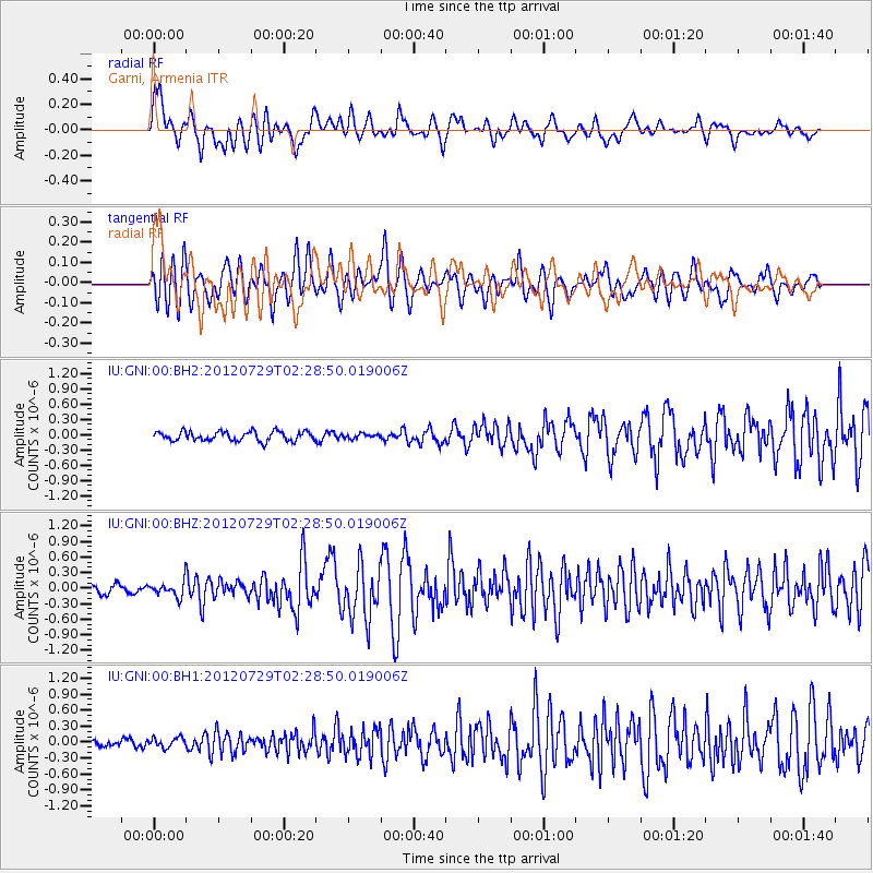
GNI Garni, Armenia - Earthquake Result Viewer
*The percent match for this event was below the threshold and hence no stack was calculated.
| Earthquake location: |
Myanmar |
| Earthquake latitude/longitude: |
22.9/94.3 |
| Earthquake time(UTC): |
2012/07/29 (211) 02:21:12 GMT |
| Earthquake Depth: |
75 km |
| Earthquake Magnitude: |
5.8 MB, 5.7 MW, 5.8 MW |
| Earthquake Catalog/Contributor: |
WHDF/NEIC |
|
| Network: |
IU Global Seismograph Network (GSN - IRIS/USGS) |
| Station: |
GNI Garni, Armenia |
| Lat/Lon: |
40.15 N/44.74 E |
| Elevation: |
1609 m |
|
| Distance: |
45.0 deg |
| Az: |
304.398 deg |
| Baz: |
97.073 deg |
| Ray Param: |
$rayparam |
*The percent match for this event was below the threshold and hence was not used in the summary stack. |
|
| Radial Match: |
76.54865 % |
| Radial Bump: |
400 |
| Transverse Match: |
68.3859 % |
| Transverse Bump: |
382 |
| SOD ConfigId: |
558545 |
| Insert Time: |
2013-09-19 23:02:47.363 +0000 |
| GWidth: |
2.5 |
| Max Bumps: |
400 |
| Tol: |
0.001 |
|
Signal To Noise
| Channel | StoN | STA | LTA |
| IU:GNI:00:BHZ:20120729T02:28:50.019006Z | 1.9262711 | 1.4828152E-7 | 7.697853E-8 |
| IU:GNI:00:BH1:20120729T02:28:50.019006Z | 1.2694708 | 9.4033155E-8 | 7.407272E-8 |
| IU:GNI:00:BH2:20120729T02:28:50.019006Z | 0.46935835 | 4.4036216E-8 | 9.382216E-8 |
| Arrivals |
| Ps | |
| PpPs | |
| PsPs/PpSs | |


