You are here: Home > Network List > US - United States National Seismic Network Stations List
> Station MNTX Cornudas Mountains, Texas, USA > Earthquake Result Viewer
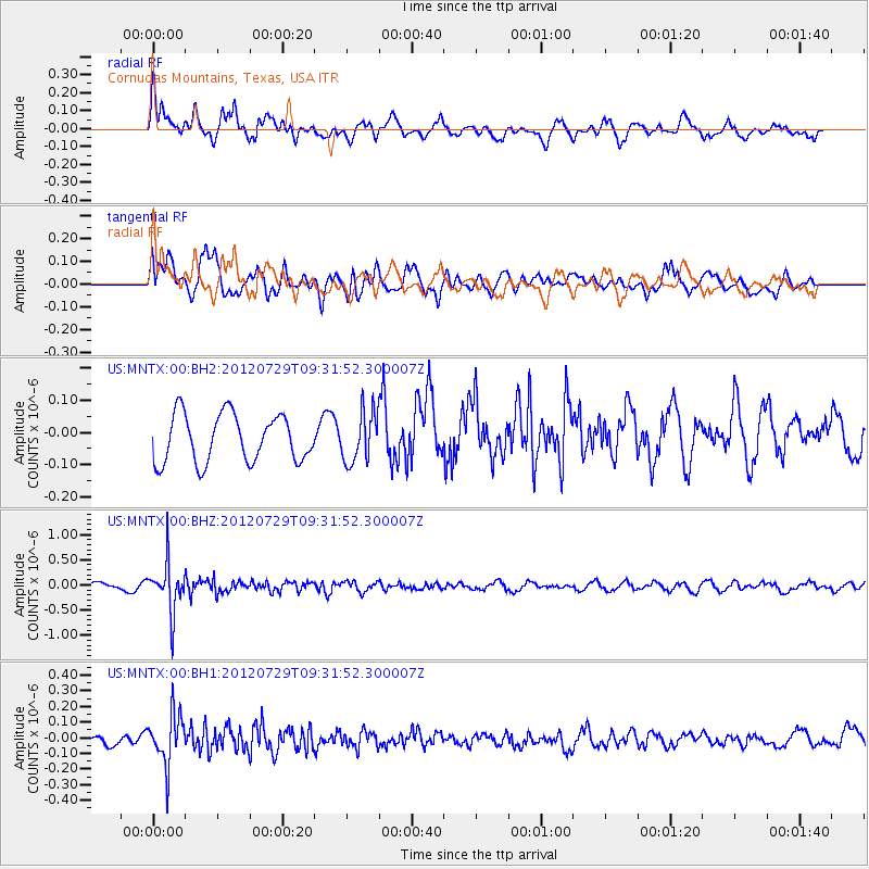
MNTX Cornudas Mountains, Texas, USA - Earthquake Result Viewer
*The percent match for this event was below the threshold and hence no stack was calculated.
| Earthquake location: |
Primor'ye, Russia |
| Earthquake latitude/longitude: |
47.4/139.1 |
| Earthquake time(UTC): |
2012/07/29 (211) 09:20:54 GMT |
| Earthquake Depth: |
502 km |
| Earthquake Magnitude: |
5.6 MB, 5.6 MW, 5.7 MW |
| Earthquake Catalog/Contributor: |
WHDF/NEIC |
|
| Network: |
US United States National Seismic Network |
| Station: |
MNTX Cornudas Mountains, Texas, USA |
| Lat/Lon: |
31.70 N/105.38 W |
| Elevation: |
404 m |
|
| Distance: |
82.3 deg |
| Az: |
50.9 deg |
| Baz: |
321.776 deg |
| Ray Param: |
$rayparam |
*The percent match for this event was below the threshold and hence was not used in the summary stack. |
|
| Radial Match: |
59.389107 % |
| Radial Bump: |
400 |
| Transverse Match: |
52.217358 % |
| Transverse Bump: |
400 |
| SOD ConfigId: |
558545 |
| Insert Time: |
2013-09-19 23:07:44.479 +0000 |
| GWidth: |
2.5 |
| Max Bumps: |
400 |
| Tol: |
0.001 |
|
Signal To Noise
| Channel | StoN | STA | LTA |
| US:MNTX:00:BHZ:20120729T09:31:52.300007Z | 7.4496565 | 4.8030824E-7 | 6.447388E-8 |
| US:MNTX:00:BH1:20120729T09:31:52.300007Z | 4.6042233 | 1.6200055E-7 | 3.518521E-8 |
| US:MNTX:00:BH2:20120729T09:31:52.300007Z | 1.034484 | 7.673295E-8 | 7.417509E-8 |
| Arrivals |
| Ps | |
| PpPs | |
| PsPs/PpSs | |


